Best Airports for Getting to Niagara Falls (USA vs Canada) [2021]

Niagara Falls is a bucket list and dream destination for many people. It is truly a spectacular display of nature’s power (and fury) and will leave a lasting impression on just about anybody. But when it comes to getting to Niagara Falls via air travel, there are several different ways you can go about it.

In this article, I will break down the three major airports you might use to get to Niagara Falls in Toronto, Buffalo, and the surrounding area, and I’ll explain their pros and cons. I’ll also talk about which is the better side to stay on: USA vs Canada.

Niagara Falls map & geography

If you were not aware, Niagara Falls sits on the border between Canada and the US. Specifically, it’s the border between Ontario, Canada and New York, USA. 

Also, Niagara Falls is actually a collection of three waterfalls: 

  • Horseshoe Falls
  • American Falls
  • Bridal Veil Falls

The Horseshoe Falls is the main attraction and is on mostly the Canadian side while American Falls and the Bridal Veil Falls are on the American side. There is also a park on Goat Island that straddles the falls and sits on the American side. 

Satellite view of Niagara Falls
Image via Google Maps.

In many cases it could make sense to fly from the US to Canada in order to visit the Falls. But if you don’t have a passport or you don’t want to fly into Canada you can still fly into airports located in the US and make a short drive to the falls.

You can drive across a bridge (Rainbow Bridge) and cross between the countries if you’d like but you’ll have to pass through immigration and keep in mind that line can be long during holidays. 

I will talk a little bit more about which side is the best side to stay on later on in the article so be sure to stick around for that.

American Falls and Bridal Veil Falls
The American Falls and Bridal Veil Falls (on the right).

Tip: Use the free app WalletFlo to help you travel the world for free by finding the best travel credit cards and promotions!

What are the best airports for flying to Niagara Falls?

Here are the best airports when flying to Niagara Falls:

  • Toronto Pearson International Airport (YYZ)
  • Buffalo Niagara International Airport (BUF)
  • Niagara Falls International Airport (IAG)

Hamilton (YHM) and Billy Bishop Toronto City Airport (YTZ) are additional choices but I’m not going to cover them due to limited airlines and routes.

Toronto Pearson International Airport (YYZ)

Toronto Pearson International Airport is a busy airport (31st-busiest airport in the world) and you can find many airlines that fly into it from all around the US. Just take a look at the route map to get a sense of all of the nonstop flights you can get to and from YYZ. They are all over the map.  

Route map to Toronto
Image via Flightconnections.com.

This means that this will be the easiest airport for you to find a nonstop flight to Niagara Falls. Air Canada is a popular airline that flies to many of these different cities across the US and could be an easy way to get there. But you can also find flights with other major airlines like United, American Airlines, Delta, and WestJet. 

Tip: Since Air Canada is a member of the Star Alliance, you can book their flights if you have frequent flyer miles with programs like United Airlines. 

Tip #2: Don’t get Toronto Pearson International Airport (YYZ) confused with Billy Bishop Toronto City Airport (YTZ).  

When we flew to Niagara Falls a couple of years ago we flew on United and Air Canada from Houston to Toronto. We decided to rent a car and just drive over to Niagara Falls from Toronto. The drive takes about one hour and 15 minutes depending on the type of traffic that you encounter.

Some of the drive is right along Lake Ontario so you would think it would be very scenic but I remember mostly just seeing highway. However, it was interesting to pass through some of the canals and check them out. 

If you were to take an Uber from Toronto Pearson International Airport to Niagara Falls you would likely be paying around $150 Canadian Dollars or around $110 USD (these rates can fluctuate by a lot though).

Buffalo Niagara International Airport (BUF)

Buffalo Niagara International Airport is closer to Niagara Falls than Toronto Pearson International Airport. If you are driving from Buffalo Niagara International Airport, it is possible that you could get to Niagara Falls in about 40 minutes. So if you think you might be in a time crunch this could save you a little bit of time.

The major issue for flying into this airport is that they just don’t serve as many nonstop locations as the Toronto airport does. As you can tell from the route map below, there are not a whole lot of cities to choose from, so if you go through BUF you might have to work in a connection or two to get there. 

Route map to Erie County
Image via Flightconnections.com.

If you do fly into Buffalo chances are you will be flying on one of the following airlines:

  • Southwest Airlines
  • JetBlue
  • American
  • Delta
  • United
  • Frontier

One of the advantages of this option is that if you don’t have a passport and you are staying on the US side of Niagara Falls then you can go this route. With that said, I would highly recommend that you stay on the Canadian side and I will say more about that below. 

If you were to take an Uber from Buffalo Niagara International Airport to Niagara Falls you would likely be paying around $35. Also, in case you’re wondering, Niagara Falls is about a 6.5 hour drive from Manhattan, New York.

Niagara Falls International Airport (IAG)

Niagara Falls International Airport is the smallest of the three airports. This is the closest airport to Niagara Falls and you could get there in about 20 minutes by driving. This airport is also on the United States side so you would not need a passport to make your way through the airport.

 You likely will not be flying to this airport but if you do you will be on one of the following airlines in most cases:

  • Spirit Airlines
  • Allegiant

These airlines are known for being some of the cheapest low cost carriers. You can often find some ridiculously cheap prices but keep in mind that they do have certain restrictions with baggage fees and other charges (You can read more about Spirit Airlines baggage fees here). Also, since this is a smaller airport the prices may be higher than usual sometimes, so always compare your prices with other airports. 

The trick with these airlines is that they do not fly to many destinations as you can tell by the route map below. Therefore, if you are trying to fly into this airport you will almost certainly have to have a connection unless you’re flying from the Southeast. Those added connections could add significant costs to your flight so keep that in mind.

Route map to Niagara Falls
Image via Flightconnections.com

Also, these airlines do not fly to these airports every day of the week. In some cases they may only make the trip two times a week so you will really have to time up your trips in order to take advantage of these lower-cost carriers.

If you were to take an Uber from Niagara Falls International Airport to Niagara Falls you would likely be paying around $18. So as you can see, traveling through this airport could be very cheap if you can find the routing.

Tip: Use WalletFlo for all your credit card needs. It’s free and will help you optimize your rewards and savings!

Which side of Niagara Falls to stay on?

I highly recommend all people to stay on the Canadian side of Niagara Falls. And that is for a few reasons. The first is that there are just better hotels on this side. When we stayed there we stayed at the Marriott Fallsview and it was a great hotel with a fantastic view of the Falls. I would highly recommend staying there. 

The second reason is that you have better views of the Falls. You can see the American falls and you can see the Horseshoe Falls. And there is just more to do on the Canadian side. It has a much better tourist infrastructure there with more restaurants and places to see. For example, you can go up in the Skylon Tower and check out the amazing aerial view of the Falls. 

Niagara Falls view from Skylon Tower
View from the Skylon Tower.

The best time of year to visit Niagara Falls

The best time of year to visit Niagara Falls depends on your personal preferences but I’d shoot for the summer (July through August). The average highs are in the low 80s so the temperature is very bearable. And the best part is that you’ll be able to take advantage of all the water activities that shut down for the winter. But those are peak season times so crowds can be an issue. 

June and September will be more on the side of shoulder season so the crowds would be thinner at that time of year and if you visit in true shoulder season (think May or October) you could take advantage of lower hotel rates. Just keep in mind that weather can be a bit unpredictable at Niagara Falls, especially during shoulder season times. 

If you do want to visit in the winter, I’d wait until January or February when the snow and ice should be present so you can witness the winter wonderland. It could be there before but it’s not a guarantee. We visited in December and while we had to deal with the cold, we didn’t get rewarded with any snow (I realize that’s not exactly a reward to everyone).

Final word

Overall, you will just have to pick a route to Niagara Falls that makes sense for you and your travel goals. If you don’t mind driving in from about an hour away and you have a passport for international travel then going through Toronto can be a great choice. Plus you can check out the city of Toronto. 

At the same time if you would like to be a little bit closer or perhaps avoid international travel then going through Buffalo can make a lot of sense as well. And finally if you don’t mind connections or if you live in certain parts of the country then you could fly into the smaller airport at Niagara Falls.

Whatever you end up doing, just stay on the Canadian side so that you can get more from the experience!  

Ultimate Guide to Major Ohio Airports (Airlines & Maps)

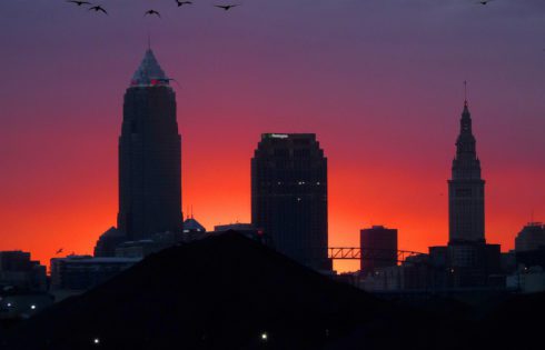
Are you trying to find out more about Ohio airports, such as where these airports are located and what destinations and airlines they serve? 

In this article, I will tell you everything you need to know about the major airports in Ohio. I’ll go over how long it will take you to get to these airports from the heart of the nearby cities and give you some insight into which airlines serve these airports along with some info on lounges and terminal maps.

Major Ohio airports overview

Ohio is not home to one of the top 25 (or even top 40) busiest airport in the US. So, as you might expect the service is going to be quite limited when it comes to international destinations. If you are trying to fly internationally there is a good chance that you will have to connect through a neighboring state or somewhere else, so keep that in mind.  

The good news is that these airports won’t be as busy and difficult to navigate as other larger airports. In many cases, you can pop in and out of these airports very efficiently. 

How many airports are in Ohio?

There are approximately 37 airports in Ohio but there are only a hand full of major airports for passenger traffic on commercial airlines. Below, I’m going to focus on the major airports although I’ll also list some relevant airports nearby the cities that you might want to also check out.

Tip: Use WalletFlo for all your credit card needs. It’s free and will help you optimize your rewards and savings!

Airports near Cleveland, Ohio

Cleveland-Hopkins International Airport (CLE)

Cleveland-Hopkins International Airport (CLE) is the busiest airport in the entire state of Ohio with over 4,000,000 enplanements per year. Depending on the traffic, you can make it up from the center of the city of Cleveland to the airport in about 15 to 20 minutes.

Hopkins is a focus city for Frontier Airlines, which is one of the ultra low cost carriers in the US. They offer very low fares to various destinations across the country but they are known for having some of the more expensive baggage fees. So in many cases, it can be very cheap to get to Cleveland from other cities across the US.  

CLE is the only airport in Ohio that offers nonstop transatlantic flights to Europe (Iceland), so if you are trying to get to Iceland efficiently and you live in the state of Ohio, CLE is probably the option you want to go with.

2020 Update: This route is no longer available.

Direct flight routes map from Cleveland Ohio
Direct flight routes map from CLE as of February 2019 (via FlightConnections.com).

CLE does not have many lounges but they do have a United Airlines United Club along with a USO Lounge, and Bar Symon. They also have an Airspace Lounge, which is one of the lounges that you can access with the Amex Platinum.

If you’re curious about what the CLE terminal map looks like, I’ve included it below. The airport consists of three main concourses: A, B, and C. 

  • Concourse A: Air Canada, American, JetBlue, and United
  • Concourse B: Southwest, Delta
  • Concourse C: Allegiant, Frontier, IcelandAir, Spirit

There are three security checkpoints you might use and their hours are below: 

  • North Checkpoint: 4:15am to 8:00am
  • Central Checkpoint (TSA Pre-Check Only): 4:00am to 8:00pm
  • South Checkpoint: Sun to Fri 4:00am to 8:00pm / Sat 3:30am to 7:15pm

If you don’t know what TSA Pre-Check is, you can read more about it here

As for restaurants, you can look up the CLE restaurants and shopping here. You’ll notice that they have many familiar eating establishments like Chick-fil-A, Subway, Cinnabon, Auntie Anne’s, etc. 

Map of Cleveland airport
Image via www.clevelandairport.com.

Other nearby airports: 

Burke Lakefront Airport (BKL)

Cuyahoga County Airport (CGF)

Cleveland Hopkins International Airport
Cleveland-Hopkins International Airport (CLE). Photo by Tim Evanson via Flickr.

Airports near Columbus, Ohio 

John Glenn Columbus International Airport (CMH)

John Glenn Columbus International Airport (CMH), formerly known as Port Columbus International Airport, is the second busiest airport in the state of Ohio, not too far behind CLE. The airport is located only 6 miles east of downtown Columbus, Ohio. Depending on traffic, you could get to the city in under 15 minutes and to Ohio State University in under 20 minutes via automobile. 

It’s also about 75 miles from Athens, Ohio so if you’re looking for an airport near Athens, CMH is only about 1.5 hours away. 

You can find direct flights from CMH to approximately 140 destinations with various airlines. If you are trying to fly to an airline hub for a major carrier like Delta, American, United, Southwest, Alaska, etc., you should have plenty of options to choose from.

This is especially the case if you are flying Southwest Airlines. While Columbus is not a Southwest hub or even a focus city, it does serve several Southwest locations, including:

  • Atlanta
  • Baltimore
  • Boston
  • Chicago–Midway
  • Dallas–Love
  • Denver
  • Fort Lauderdale
  • Fort Myers
  • Houston–Hobby
  • Las Vegas
  • Nashville
  • Orlando
  • Phoenix–Sky Harbor
  • St. Louis
  • Tampa
  • Washington–National

While this is technically an international airport the only international arrivals come from Cancun, Punta Cana (seasonal?), and Toronto. 

Direct flight routes map from John Glenn Columbus International Airport
Direct flights from CMH as of February 2019 (via FlightConnections.com).

The only lounge currently found at this airport is the Jake Brewer USO Lounge.

There are three main concourses at CMH: 

  • Concourse A: Southwest
  • Concourse B: Air Canada, American, Spirit, and United
  • Concourse C: Delta, Frontier, Vacation Express

If you want to view a terminal map, I suggest checking out the interactive map here. You can also view the different shops and restaurants in the airport which include: 

  • American Craft Tavern
  • Auntie Anne’s Pretzels
  • Bob Evans Express
  • Burger King
  • Charley’s Philly Steaks
  • Chili’s Too
  • Eddie George’s Grille 27
  • PGA TOUR Grill
  • And many others

Rickenbacker International Airport (LCK)

Rickenbacker International Airport (LCK) is yet another airport located in the city of Columbus. This airport receives significantly less traffic than John Glenn, however. You’ll mostly find flights with Allegiant flying out of this airport, and it primarily serves airports in the Southeast US, including Florida, Georgia, and South Carolina. 

Direct flight routes map from Rickenbacker International Airport
Direct flights from LCK as of February 2019 (via FlightConnections.com).

Other nearby airports: 

Ohio State University Airport (OSU)

Aerial view of John Glenn Columbus International Airport
John Glenn Columbus International Airport (CMH). Photo by Mark Cameron via Flickr.

Airports near Dayton, Ohio

James M. Cox Dayton International Airport (DAY)

James M. Cox Dayton International Airport (DAY), formerly Dayton Municipal Airport and James M. Cox-Dayton Municipal Airport, is located 10 miles north of downtown Dayton. James Cox is the third busiest airport in the state of Ohio. 

This airport is known as a primary commercial service airport and is home to the annual Vectren Dayton Air Show. There are not many airlines served at this airport and service is limited to Allegiant Air, American Eagle, Delta, and United Express. With such limited service, there are only a few direct routes to places in the US mostly along the East Coast and central US. 

Direct flight routes map from James M. Cox Dayton International Airport
Direct flights from DAY as of February 2019 (via FlightConnections.com).

There are two lounges at DAY: a USO Lounge and a Business Travelers Center. 

Tip: Use WalletFlo for all your credit card needs. It’s free and will help you optimize your rewards and savings!

Other nearby airports: 

Montgomery Co Airport (MGY)

Airports near Cincinnati, Ohio

Cincinnati Municipal Lunken Airport (LUK)

Cincinnati Municipal Lunken Airport (LUK) is a very small airport, Located just 3 miles south east of downtown Cincinnati. The airport serves a lot of private aircraft in the fleet of local corporations although it does serve a few commercial flights.

Outside Cincinnati Municipal Lunken Airport
Lunken Airport. Photo via Flickr.

Cincinnati/Northern Kentucky International Airport (CVG)

Cincinnati/Northern Kentucky International Airport (CVG) is a larger and close by airport that is located about 20 to 25 minutes outside of downtown Cincinnati in the city of Hebron, Kentucky, about 45 to 50 minutes south of Mason, Ohio and an hour south of Oxford, Ohio.

It is known for Housing the headquarters for Amazon Air, Delta Private, DHL Americas, and Southern Air. But the airport is also a focus city for Allegiant Air, Delta Air Lines, and Frontier Airlines and serves many hubs around the US, making it a prime choice for those in the Cincinnati area with real travel needs. CVG also has a direct flight to Paris via Delta.

Direct flight routes map from Cincinnati/Northern Kentucky International Airport
Direct flight route map from CVG as of February 2019 (via FlightConnections.com).

There are five lounges at this airport, including two USO lounges. You can also find a Delta Airlines Delta sky club, Graycliff Divans Lounge, and The Club at CVG Lounge. You can check out the terminal maps here

Airports near Akron, Ohio 

Akron-Canton Regional Airport (CAK)

Akron-Canton Regional Airport (CAK) is a commercial airport in the city of Green, in southern Summit County, Ohio. This airport considers it to be a “reliever” airport, meaning that travel through here is easier than nearby Cleveland Hopkins International Airport, which is significantly larger. 

The airlines is served here are significantly limited to only a handful which include: American Eagle, Delta Air Lines, Delta Connection, Spirit Airlines, and United Express. These airlines only serve a few states in the surrounding area but service with United does stretch as far as Houston, Texas.

There is one lounge at this airport: the Ohio Desk Business Center.

Airports near Toledo, Ohio

Toledo Express Airport (TOL)

Toledo Express Airport (TOL) is a smaller airport with fewer than 100,000 enplanements each year. It is actually a joint civil-military airport in the Swanton and Monclova townships ten miles to the west of Toledo in western Lucas County, Ohio. It’s also about 55 minutes north of Findlay, Ohio. 

This airport is used by both passenger and cargo airlines and is home to Ohio Air National Guard’s 180th Fighter Wing. The airport also serves as a secondary airport to Detroit Metropolitan Airport (DTW).

Other nearby airports: 

Toledo Airport (TDZ)

Airports near Youngstown, Ohio 

Youngstown–Warren Regional Airport (YNG)

Youngstown–Warren Regional Airport (YNG) is a public and military airport in Vienna Township, Trumbull County, Ohio, 11 miles north of Youngstown and 10 miles east of Warren. It is home to the Youngstown–Warren Air Reserve Station. 

Final word 

As you can tell, there are several different airports that you can choose from when flying into and out of Ohio. None of the airports offer significant international travel opportunities so in many cases you will need to connect to another airport if that is your goal. However, a few of these airports are well-connected to other major airline hubs all across the US.

Cover photo by bk via Flickr