Hamilton Pool: Texas’ Most Stunning Natural Swimming Hole
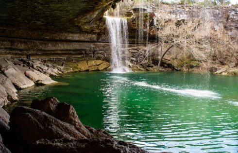
A light trickle finds its way over the moss-covered cliffs and drops into the cool green waters—the small splash not even audible. There’s been yet another drought. While you’d prefer
A light trickle finds its way over the moss-covered cliffs and drops into the cool green waters—the small splash not even audible. There’s been yet another drought. While you’d prefer
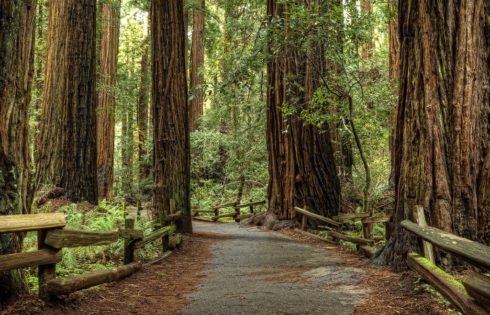
Are you looking to explore the beautiful redwood trees in California? Well, you’re in luck because there are a lot of places where you can find these beautiful towering trees
There are some truly unique national parks and national park sites in Southern California, each offering something special—from pristine islands rich in biodiversity to towering desert sand dunes. Whether you’re

Saguaro National Park’s West District may not have the same number of trails or towering peaks as the East, but what it does offer is just as rewarding—more accessible summits
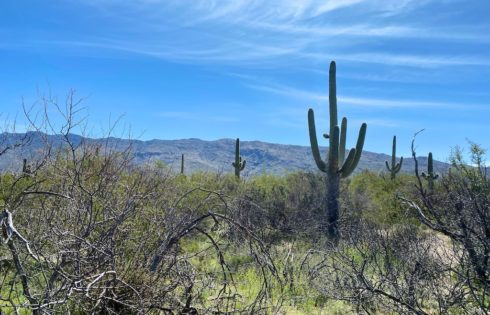
If you ask me, the saguaro cactus (pronounced “suh-wahr-oh”) might be the most iconic symbol of the American Southwest. It’s on TV shows, cartoons, and on all sorts of signage
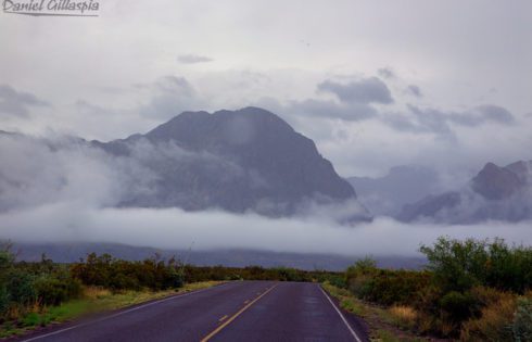
Texas is a vast and open place that can take 14 hours to make your way through on the highway, and I know this all too well as a native
Check out this list of 56 stunning destinations—from the deserts of Texas to the coasts of California and the peaks of Washington and Montana. You’ll discover hidden gems and jaw-dropping
Arizona is home to some of the most stunning landscapes on the planet. From the jaw-dropping cliffs of the Grand Canyon to the arid and rocky terrain of southern Arizona,
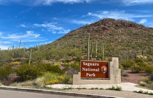
Saguaro National Park is home to the iconic Saguaro cactus and one of the best parks in Arizona. It’s divided into two sections: the East District (Rincon Mountain District) and
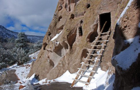
New Mexico is filled with some stunning national parks and monuments that you don’t want to miss. With such a varied landscape and unique history you’ll find a little bit
