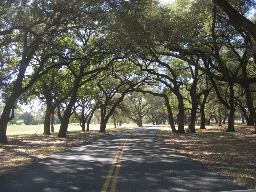
Texas is a vast and open place that can take 14 hours to make your way through on the highway, and I know this all too well as a native Texan. But Texas is also home to quite a few national park sites, many of which other people don’t know about. Here’s a quick guide to National Parks in Texas.
How many national parks are in Texas?
There are two national parks in Texas (Big Bend and Guadalupe Mountains National Park) but a total of sixteen National Park sites in Texas when including sites, such as national monuments and national historic sites.
Tip: Use the free app WalletFlo to help you travel the world for free by finding the best travel credit cards and promotions!
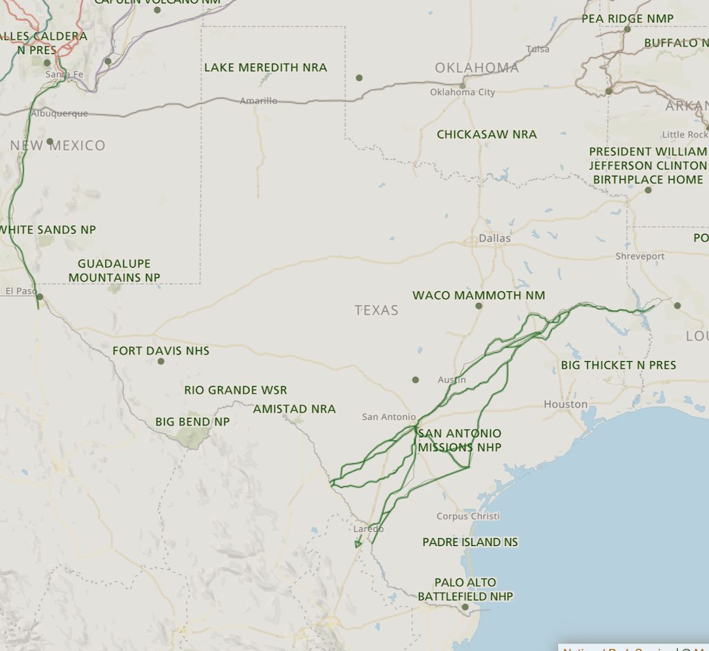
Map of national parks in Texas
The two official national parks in Texas are located in far west Texas as you can see in the map. Guadalupe Mountains national park is on the border of Texas and New Mexico while Big Bend National Park is in the “bend” of Texas right on the border of Texas and Mexico.
However, when it comes to the national park sites, they are are spread all over the state. Located at just about every corner of Texas you’ll find a national park site.
Texas national park pass?
There is no national park pass specific to Texas national parks. Instead, you can look into purchasing the national park annual pass which will give you access to all national parks and many other federal lands for the span of a year. (There is a separate annual pass for Texas state parks you can look into.)
So with that information out of the way, here are the national parks in Texas you came to find out more about.
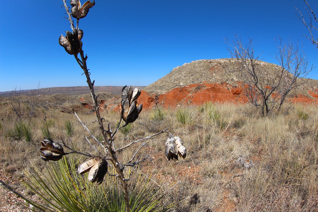
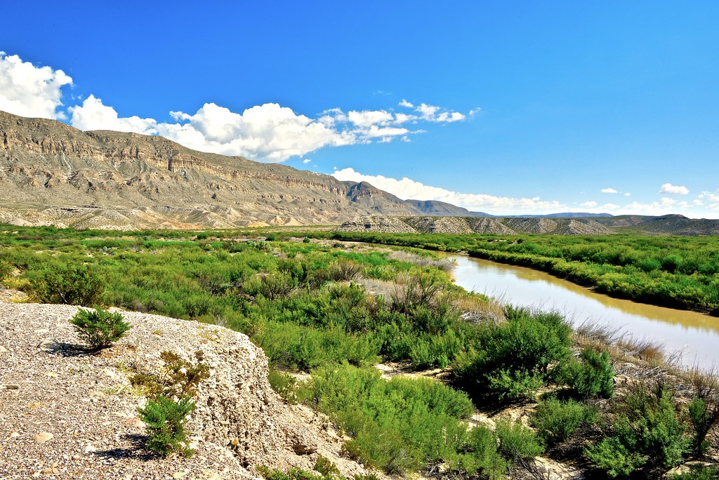
1. Big Bend National Park
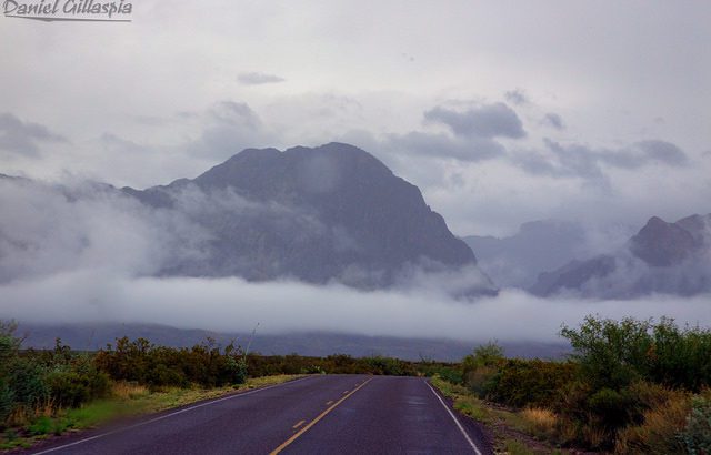
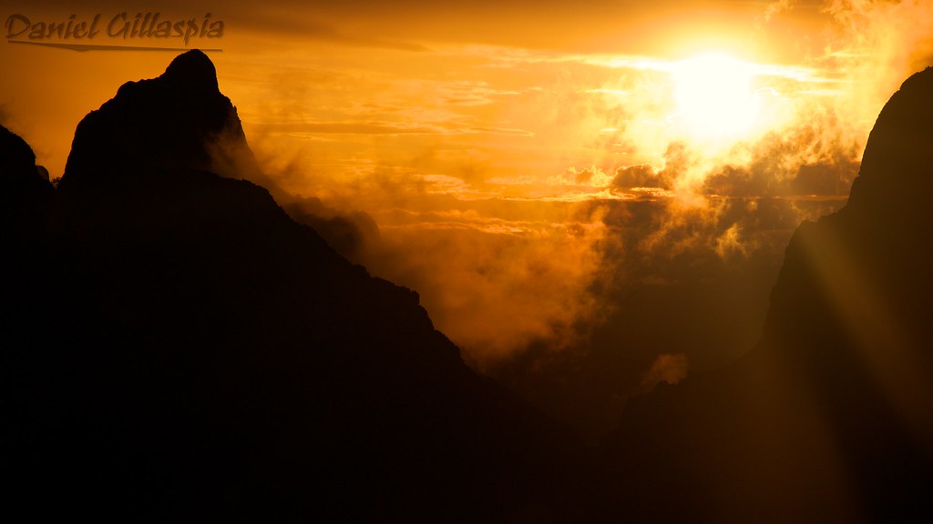
Big Bend National Park is one of the most famous national parks in Texas but it’s still one of the lesser-known national parks due to its remote location. But its remoteness is also a major perk of this national park because that often means less crowds and little to no light pollution, as Big Bend National Park has some of the darkest skies in the US.
There are a lot of things you can do in Big Bend National Park, especially if you’re into hiking, photography, or just getting off the grid.
Big Bend is known for The Window, a dramatic V-shaped canyon that perfectly frames the sunset. You can admire it from afar or hike the Window Trail, a 5.6-mile round-trip trail that starts right from the Chisos Basin. If you’re staying at the Chisos Mountain Lodge, you’re just 30 seconds from the overlook—one of the best sunset spots I’ve ever experienced.
Another must-do is exploring Santa Elena Canyon, where the Rio Grande slices through towering cliffs up to 1,500 feet high. Depending on the season, you can kayak or canoe through the canyon, which is an unforgettable way to take it in. If you’re staying on dry land, the Santa Elena Canyon Trail is an easy 1.7-mile round-trip hike that leads you right into the heart of the canyon. Nearby, you’ll also find a natural hot spring—a 105-degree pool beside the river that’s especially soothing after a long day on the trails.
If you’re looking for a bit more of a challenge, hike to Emory Peak, the highest point in Big Bend at 7,825 feet. The trail is a 10.5-mile round trip and ends with a short rock scramble to the summit, but the 360-degree views from the top are absolutely worth it. You’ll see the Chisos Mountains stretch out in every direction, with the desert floor far below.
Other great hikes include the Lost Mine Trail (4.8 miles round-trip), which offers sweeping views without too much climbing, and the South Rim Trail, a strenuous 12–14 mile loop with what many say are the best views in all of Texas.
Big Bend is remote, vast, and wildly underrated—and that’s exactly what makes it unforgettable.
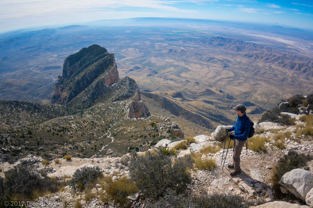
2. Guadalupe Mountains National Park
When it comes to national parks in Texas, Guadalupe Mountains National Park is definitely one of the least known parks in the state. It doesn’t get the attention of Big Bend but it still has a lot to offer.
One of the coolest features of this park is that it’s home to the four highest peaks in the state of Texas and also the most extensive Permian fossil reef.
It is also one of the few places in Texas where you can witness dramatic color change mid-October through mid-November. (Lost Maples State Park is probably the prime location for color change in Texas.)
As far as hiking goes, you’ve got several options including Devil’s Hall Trail, Smith Spring Loop, McKittrick Canyon Trail, and Guadalupe Peak Trail.
Guadalupe Peak Trail is the trail that will take you to the tip of Texas — Guadalupe Peak. This is a 8.5 mile round-trip hike that requires about 5-8 hours. This can be a brutal hike during high temperatures and requires some scrambling at the end, so you want to have some experience before attempting this hike (it’s rated as strenuous).
The peak is 8,751 feet above sea level so we’re not talking about Rocky Mountain peaks here but with a 3,000 foot gain in elevation and some steep terrain, this isn’t exactly a beginner hike either.
More national parks in Texas
Big Bend National Park and Guadalupe Mountains National Park are the only two true national parks in Texas. However, there are many more National Park sites in Texas.
These National Parks in Texas are a mix of national monuments, recreation areas, preserves, memorials, trails, historical parks. Each has a lot of unique appeal and history to offer but I’ll just provide the tip of the iceberg for these destinations.
3. Alibates Flint Quarries National Monument (Fritch, TX)
If you’re into geology then you’ll love this place.
The multitude of colors found at the Alibates Flint Quarries are caused by trace mineral elements within the silica found in the silicified dolomite. The red, orange and yellow colors are caused by iron, while the blues and greens are typically a product of manganese.
Scientists hypothesize that the colorful flint here originated roughly 670,000 years ago when volcanic eruptions all the way from Yellowstone Country in Wyoming spewed silica rich ash that drifted over. After the ash mixed with rainwater and the silica dissolved and dolomite washed out, the flint was left over.
13,000 years ago mammoth hunters used this area to find stones to build their hunting tools. From 1100 A.D. to 1500 A.D, the Antelope Creek people called this place home and today you can still find their petroglyphs when taking the ranger-guided hike to the village site.
The Alibates Visitor Center also has interesting exhibits to discover that reveal more about this place’s history.
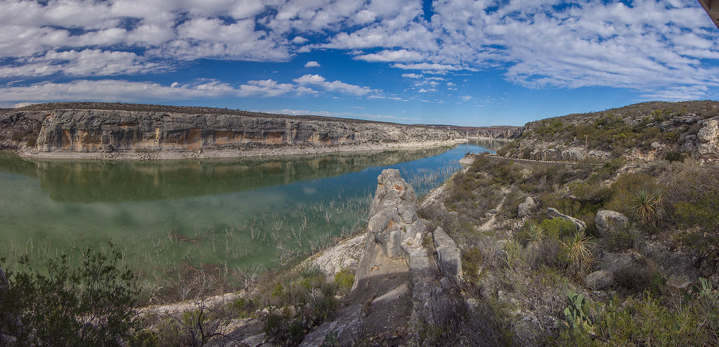
4. Amistad National Recreation Area (Del Rio, TX)
Amistad National Recreation Area consists of the US portion of the International Amistad Reservoir and its name derives from the Spanish word meaning “friendship.” This site is known for its water-based recreation (boating, fishing, etc.), camping, hiking, rock art, and rich cultural history.
And with its clear waters, you can even SCUBA dive here with visibility in the winter at maximum of 40-50 feet. There’s actually an extensive network of underwater caverns that can be explored while scuba diving but those are reserved for technical divers given the risks involved.
Due to it’s location, the site receives unpredictable weather. Some years it might only receive a few inches of rain while other years it can receive an entire year’s worth of rain from a single storm. Humid air often blows in from the Gulf of Mexico during the mornings but by afternoon that humid air burns off and gives way to more desert like, dry air.
In the fall (right after the first major cold front, usually in October), Amistad National Recreation Area is a hot spot for monarch butterflies which pass through as part of their 3,000 miles migration that begins in southern Canada and runs through central Mexico.
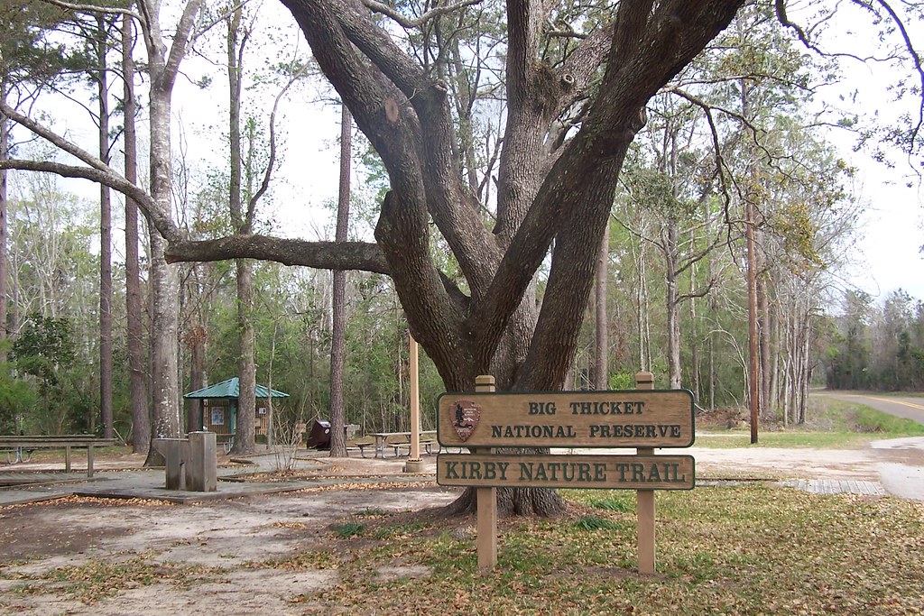
5. Big Thicket National Preserve (Beaumont, TX)
Added in 1981 to the list of International Biosphere Reserves, multiple habitats converge at this national preserve in southeast Texas. There’s an incredible diversity of life here which can be discovered via hiking trails or exploring creeks, bayous, and the Neches River via kayak.
You’ll be able to make your way through nine different ecosystems, from longleaf pine forests to cypress-lined bayous with plenty of opportunities to see wildlife.
Wildlife includes bald eagles, alligators, mountain lions, foxes, otters, and coyotes, among many others. Black bears were common here once upon a time but over-hunting drove them out. Fortunately, many speculate that a species of black bear might be making a come back in the Big Thicket, utilizing the large hollow trees for dens.
Big Thicket is also home to one of the most well-known ghost stories of Texas. There’s a dirt road known as Bragg Road, which was constructed back in the 1930s over a former railroad line. Beginning in the 1940s, stories started to circulate about the a myserteous light known as the “Light of Saratoga” that could be seen on the road.
People have linked the ghost stories to the Kaiser Burnout, conquistadors looking for their buried treasure, and even a a decapitated railroad worker, but others insist on more natural explanations like the swamp gas or vehicle headlights to explain the lights.
6. Chamizal National Memorial (El Paso, TX)
These grounds serve a reminder of the reminder of the “harmonious settlement of a 100-year border dispute between the United States and Mexico.” The monument commemorate the Chamizal Convention of 1963, which was a treaty that ended a long-lasting border dispute between the U.S. and Mexico.
The 1848 Treaty of Guadalupe-Hidalgo originally established the border between the US and Mexico along the Rio Grande. But over the span of decades, flood and meandering currents pushed the Rio Grande further south which created pockets like “Cordova Island” which were areas of Mexico that ended up north of Rio Grande.
These areas were not patrolled properly and crime and smuggling became a major problem in these spots. As cities along the Rio Grande grew, the need for a clear resolution along the border grew more dire, and eventually Presidents John F. Kennedy and Adolfo López Mateos agreed on confining the river to a concrete channel in 1963.
Today, the monument is home to the The Nuevo Siglo Drama Festival which runs for a week in April and is a prime site to learn about the “larger story of the borderlands and the shared history of the United States and Mexico.”
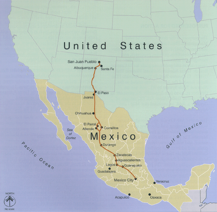
7. El Camino Real de los Tejas National Historic Trail (TX & LA)
This trail is 2,500 miles long and you can trace back the steps of some of the early settlers that explored this region and learn about the original natives who called this place home, including the Caddo people.
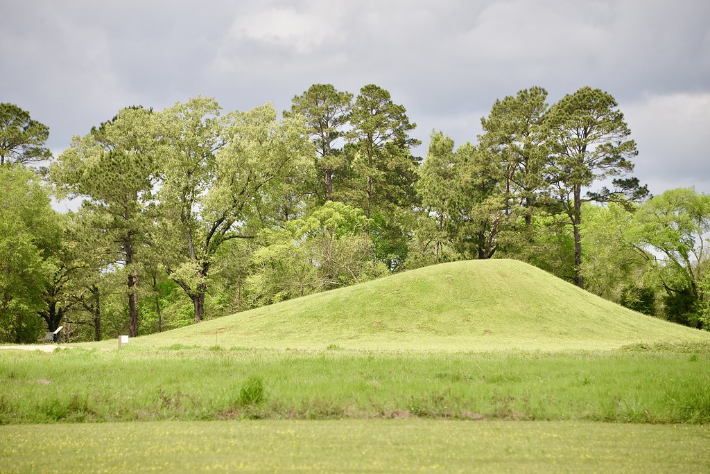
The Caddo people were early inhabitants of Texas and surrounding states of Oklahoma, Louisiana, and Arkansas. The Caddo are different from most other American Indian groups that lived in Texas because they lived and thrived in the same forested landscapes for over 1,000 years. They left behind mounds which were used for the burial of the elite and as building platforms for structures used by the elite.
At their height, around 1300, some estimate that the Caddo numbered more than 200,000 people. But by 1350, droughts diminished corn production which was the crop largely relied on by the Caddo and the population declined, as many dispersed throughout the region.
When Europeans first arrived in the region, they discovered the well-traversed trails built by the Caddo and the Spanish built missions and posts along the main trails. These collectively became known as “El Camino Real de los Tejas” which is now commemorated with the national historic trail.
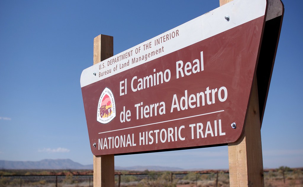
8. El Camino Real de Tierra Adentro National Historic Trail (NM,TX)
The El Camino Real de Tierra Adentro National Historic Trail allows you relive 300 years of heritage and culture in the Southwest. The trail is home to 20 other National Park sites so you can fill up that national park passport as quickly as you can.
Before Europeans arrived in the Southwestern United States, American Indian groups had established trade routes along the route of this trail with some portions being established around 1000 AD. When the Spanish first came to the region in the early 1500s, the American Indians guided them through the challenging landscape. Sometimes the Spanish even relied on their captive natives to guide them to safety when lost in the wilderness.
This was a grueling trail for the Spanish who would spend 6 months making their way north through some very harsh terrain like the crossing of the Jornada del Muerto, which consisted of a hundred kilometers of open desert with practically no way to hydrate in between.
For about 300 years, El Camino Real was the only wagon road into New Mexico and the Southwest. This made it a busy path for thousands of colonists, missionaries and supply caravans from Southern New Spain that “facilitated the introduction of horses, cattle, European agriculture and irrigation systems, exotic flora, and many cultural practices.”
You can get a sense of the signifance of this route today by visiting some of the key landmarks along the trail like the Pecos National Historical Park near Santa Fe, NM and Keystone Heritage Park in El Paso, TX which both preserve remains of early American Indian cultures in the Southwest.
9. Fort Davis National Historic Site (Fort Davis, TX)
Fort Davis is known as being “one of the best surviving examples of an Indian Wars’ frontier military post in the Southwest.” From 1854 to 1891, Fort Davis protected “emigrants, mail coaches, and freight wagons on the Trans-Pecos portion of the San Antonio-El Paso Road and on the Chihuahua Trail” and thus played a major roll in the development of the Southwest.

Fort Davis was created to protect travelers on the San Antonio-El Paso Road. In the early 1850s, the California gold rush spurred an increase in traffic along this way but the the route was plagued by raids from the Comanche, Kiowa, and Apache, so Fort Davis created a military presence along the way.
The open areas of land were so vast in this region that Fort Davis ultimately didn’t do much to keep attacks off. The troops engaged in many scouting patrols but encounters with the natives were rare. In fact, many troops commented on how boring life at Fort Davis was. Eventually, they found ways for entertainment by heading to a nearby bass lake, putting on theatrical plays, and even having weekly horse races.
They also turned to gardening here where they reportedly grew cabbages that weighed 35 pounds and celery four feet long. Something else interesting about Fort Davis is that they imported camels from the Middle East, which were better equipped than mules and horses to carry large loads in the dry lands. Although the camels were very popular, they were no longer used after the Civil War broke out.
Fort Davis is the highest town in Texas at 5,050 feet and has a population just over 1,200. There are a number of ways to explore this place like hiking or doing a self-quided tour of the five buildings that are restored and refurnished to the 1880s or exploring the other 100 ruins. You can also look into the annual night tour in October.
10. Lake Meredith National Recreation Area (Fritch, TX)
This national park in Texas is a hidden oasis located in the Texas Panhandle. It’s home to stunning 200-foot canyons where the Canadian River flows and is another site where humans roamed 13,000 years ago. You can camp, hike, fish, and find plenty of other ways to enjoy this place.
11. Lyndon B Johnson National Historic Park (Johnson City, TX)
Lyndon B. Johnson National Historical Park “tells the story of our 36th President beginning with his ancestors until his final resting place on his beloved LBJ Ranch.” You’ll get the entire picture of his life and come away with a deeper understanding of perhaps any US president when visiting this place. There’s a lot to see including the former president’s car collection.
Related: LBJ Ranch Review (What to See)
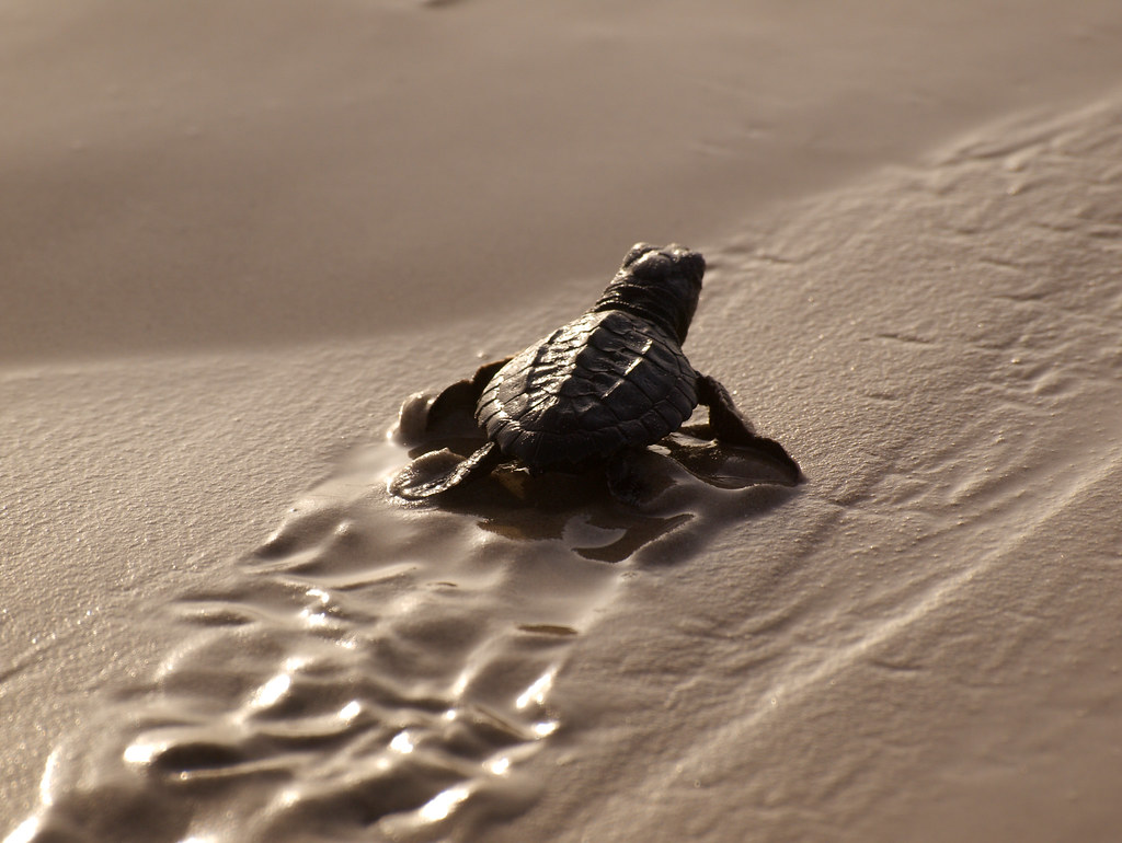
12. Padre Island National Seashore (Corpus Christi, TX)
This Seashore is known for being the longest stretch of undeveloped barrier island in the world! Padre Island National Seashore also separates the Gulf of Mexico from the Laguna Madre, which is one of a few hypersaline lagoons on the globe.
You can relax on the beach, go kayaking, or even attend a seat turtle release.
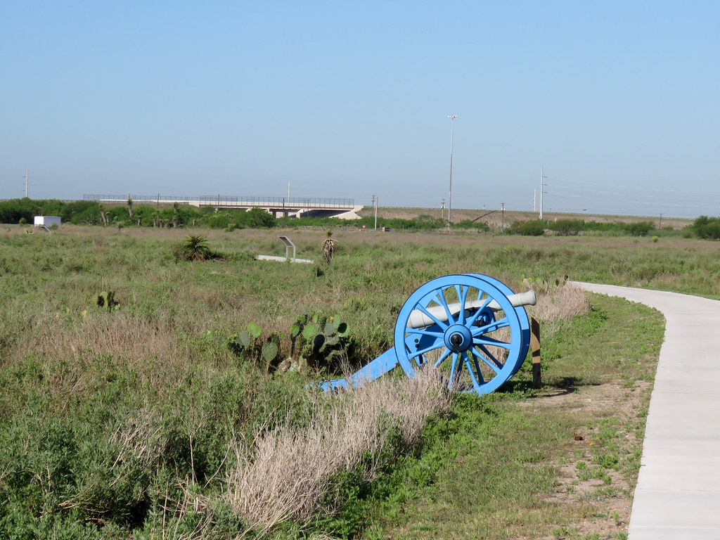
13. Palo Alto Battlefield National Historical Park (Brownsville, TX)
In 1846 the US and Mexico battled at Palo Alto, which ultimately became one of the most significant battles in the region’s history and ultimately changed the map of North American. “Palo Alto Battlefield National Historical Park preserves the site of this notable battle and provides an understanding of the causes, events, and consequences of the U.S.-Mexican War.”
Don’t get this confused with Palo Duro State Park which is about 11 hours north of this historical park!
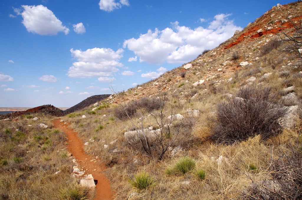
14. Rio Grande Wild & Scenic River (Southwest Texas, TX)
The Rio Grande Wild & Scenic River extends about 200 miles in the bend of Texas as you can see in the map below. Designation as a Wild & Scenic River means the rivers are to be preserved in their free-flowing condition with their ecosystems actively protected in their natural state. Only about 2% of the rivers in the U.S. are free-flowing and pristine enough to qualify for Wild and Scenic designation.
Within these parts you can experience rapids ranging from class II to class IV and some of the most dramatic and remote canyon scenery in the country.
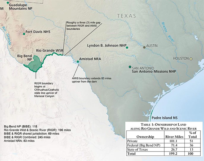
One of the most popular things to do in this area is to kayak or float the Rio Grande through one of the spectacular canyons. These trips can last for a day or even up to a couple of weeks depending on the route that you choose. So obviously, you’ll want to make sure that you make ample preparations for the trip. Most people choose between Boquillas Canyon, the Lower Canyons, or Mariscal Canyon. Each canyon offers its own perks and which canyon is best for you depends on your experience and comfort levels with navigating rivers.
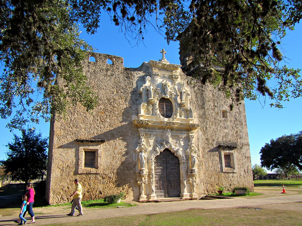
15. San Antonio Missions National Historical Park (San Antonio, TX)
There are four missions in this National Park and there are 10 miles of trail that connect extend north to The Alamo, some of which you can hike or bike on. You’ll learn all about the history of the people that occupied this region for thousands of years and the role that these Missions played in their survival.
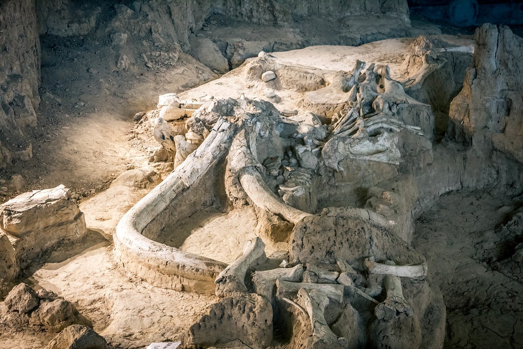
16. Waco Mammoth National Monument (Waco, TX)
This National Monument is a newcomer after President Obama designated in a national monument in 2015. According the NPS, “[t]his paleontological site represents the nation’s only recorded discovery of a nursery herd of Columbian mammoths.”
This site allows you to view “in situ” fossils which include a “female mammoths, a bull mammoth, and a camel that lived approximately 67,000 years ago.”
Final word on national parks in Texas
As you can tell there are quite a few national parks in Texas. While there are only two “true” national parks in Texas there are many national parks sites where you can explore all of the different types of wildlife, ecosystems, and rich geological and cultural history of the region. Some of these sites may take some time to get to but exploring the wide open plains, hills, and coastlines of Texas is a trip just about anyone should try.
Daniel Gillaspia is the Founder of UponArriving.com and the credit card app, WalletFlo. He is a former attorney turned travel expert covering destinations along with TSA, airline, and hotel policies. Since 2014, his content has been featured in publications such as National Geographic, Smithsonian Magazine, and CNBC. Read my bio.
