When visiting Estes Park, there’s an abundance of activities to partake in. From strolling along the Riverwalk to embarking on a ghost tour at the historic Stanley Hotel, your schedule will be packed. However, the region also boasts captivating highways that wind through breathtaking landscapes.
One such highway is the Peak to Peak Scenic Byway, offering a plethora of attractions to behold.
To ensure you don’t miss out on the highlights, I’ve compiled this guide based on my personal experiences exploring this remarkable route.
So, continue reading below for all the essential information before embarking on this journey, along with valuable tips to enhance your experience of the remarkable sights along the way!
Table of Contents
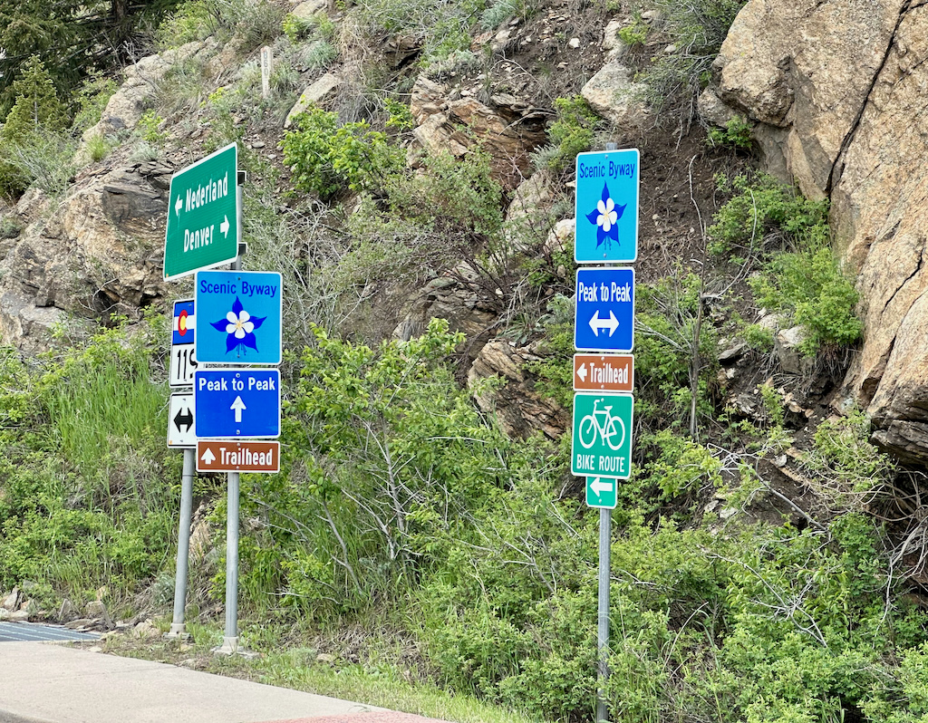
What is the Peak to Peak Scenic Byway?
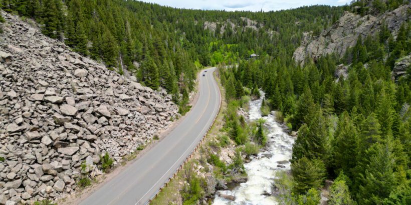
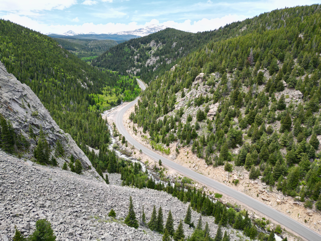
The renowned Peak to Peak Scenic Byway is 55-mile stretch of highway, extending from Estes Park to Blackhawk/ Central City, although some claim the highway unofficially ends near Idaho Springs (I-70) which would make it about 69 miles long.
Known as Colorado’s first scenic highway, this winding route guides travelers along the majestic Front Range Mountains making up the Continental Divide, providing awe-inspiring vistas of towering peaks, picturesque valleys, and the opportunity to traverse charming, time-honored mining towns.
- You’ll head through the outskirts of Rocky Mountain National Park, Arapaho and Roosevelt National Forests, and also drive in close proximity to other parks with amazing outdoor opportunities including Brainard Lake Recreational Area, Indian Peaks Wilderness Area, and Golden Gate Canyon State Park.
Related Scenic Drives:
- Guanella Pass Scenic Byway Guide (Colorado)
- Whiteface Memorial Highway Review (New York)
How long does it take to do the Peak to Peak Scenic Byway?
The amount of time it’s going to take you to complete the scenic byway depends on your termination point and how many stops you plan on taking. If you plan on doing the route between Estes Park and Idaho Springs (I-70), with minimal stops you can get through in about 1.5 hours.
More than likely though, you will want to get out and admire some of the viewpoints and maybe even grab a bite to eat or do some exploring. In that case, it’s going to take you closer to two hours to get from one side to the other.
So if you’re doing this as a roundtrip then expect it to take you 3 to 4 hours to complete.
Personally, I like doing this route when I am traveling through.
For example, we were relocating from Estes Park to our Airbnb in Georgetown, Colorado, so it made sense to make the one-way journey on the scenic byway.
We made several stops, captured some stunning drone footage (where it was legal to do so), and explored some of the smaller towns and so it took us about 3.5 hours to get through all the way.
If you were traveling between Estes Park and Denver or even Colorado Springs, this would also be a great route to choose.
However, if you’re just planning on doing the roundtrip route from Estes Park I would probably only venture to Central City and then turn around since you’re not missing too much between Central City and Idaho Springs.
Related: Argo Mill And Tunnel Tour Review: A Fascinating Look at the History of Gold Mining in Colorado
What’s the best time of year to drive the Peak to Peak Scenic Byway?
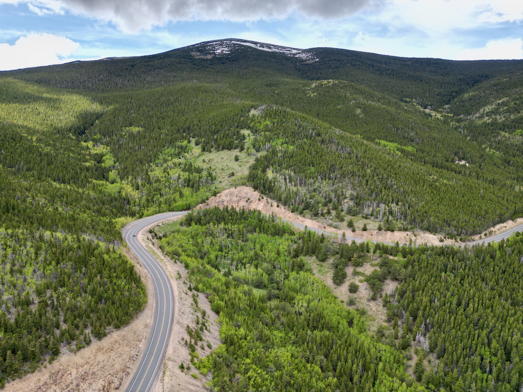
The best time of the year to do the Peak to Peak Scenic Byway is going to be during the fall color change which is typically between late September and early October.
Along the mountainsides and road sides, we saw many lime green aspen groves in June which would be a striking golden or orange color during the fall so you won’t be disappointed.
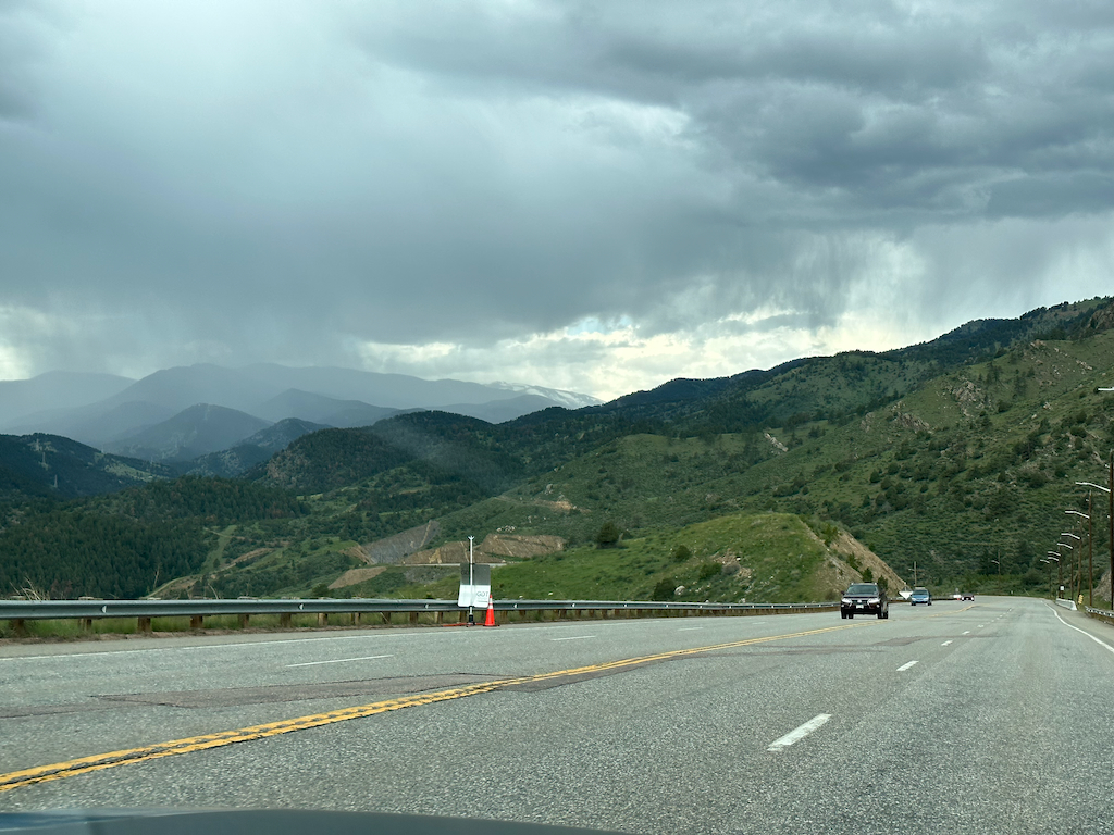
But even if you do the drive during the summer like we did, it’s still a very scenic drive with great views and you get the snow-capped Rockies in the background especially during early summer.
The Peak to Peak Scenic Byway is plowed during the winter months so should be passable as long as the road has been recently maintained. But you obviously want to be careful with icy/snowy conditions and tire chains may be necessary times.
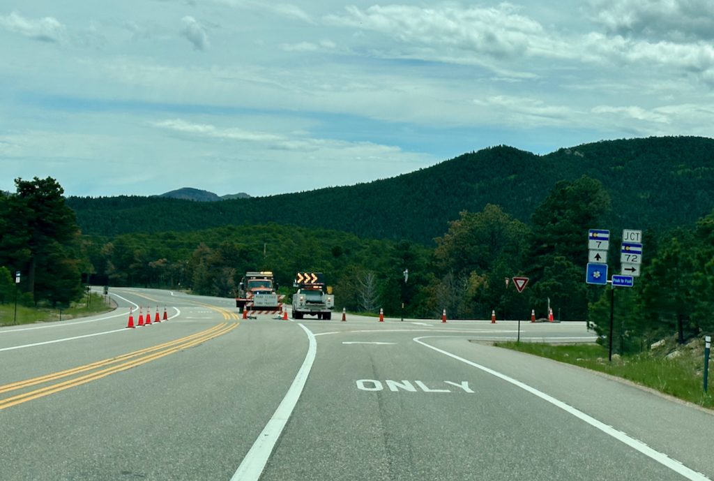
If you’re doing this during the spring such as the month of May and early June, be aware that rockslides can be fairly common in these mountain roads. When those happen, the DOT may shut down the entire roadway so be prepared to potentially encounter detours, especially on the less-traveled roads.
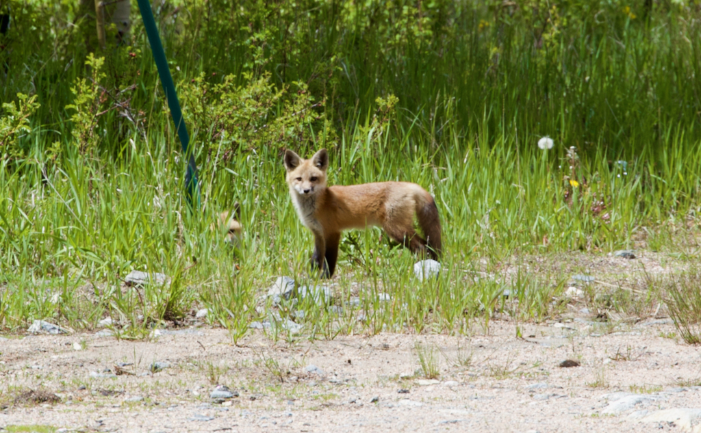
Is there wildlife to encounter along the Peak to Peak Scenic Byway?
Yes, you can encounter wildlife when enjoying the Peak to Peak Scenic Byway. This is one reason why you need to remain aware as you make your way through the beautiful scenery which can be distracting.
You may encounter moose, elk, deer, or smaller animals like a fox, like we have in the past.
Is the Peak to Peak Scenic Byway scary or motion sickness inducing?
At times, traversing a scenic byway can entail navigating hairpin turns, which can be anxiety-inducing and even trigger motion sickness for some individuals. However, as someone who occasionally experiences motion sickness, I can assure you that the Peak Scenic Byway poses no major issues.
While there are a few overlooks where you can venture close to the edge if you wish, the road itself feels secure and, although there are sections that meander slightly, it is not one of those roads that present a major challenge. Unless you are extremely sensitive to altitude and curves, you should be fine.
Do you get cell phone service on the Peak to Peak Scenic Byway?
Securing reliable cell phone service or stable data connection while traversing the Peak to Peak Scenic Byway might pose a challenge. Thus, I suggest downloading an offline map of the area onto your phone.
While you’ll likely experience improved service within towns like Nederland, there may be gaps in coverage between them, hindering access to certain data and making it occasionally troublesome to locate specific attractions along the way.
What sites are on the Peak to Peak Scenic Byway?
Starting from Estes Park and heading south, here are the main sites you’re gonna want to see when driving along the Peak to Peak Scenic Byway.
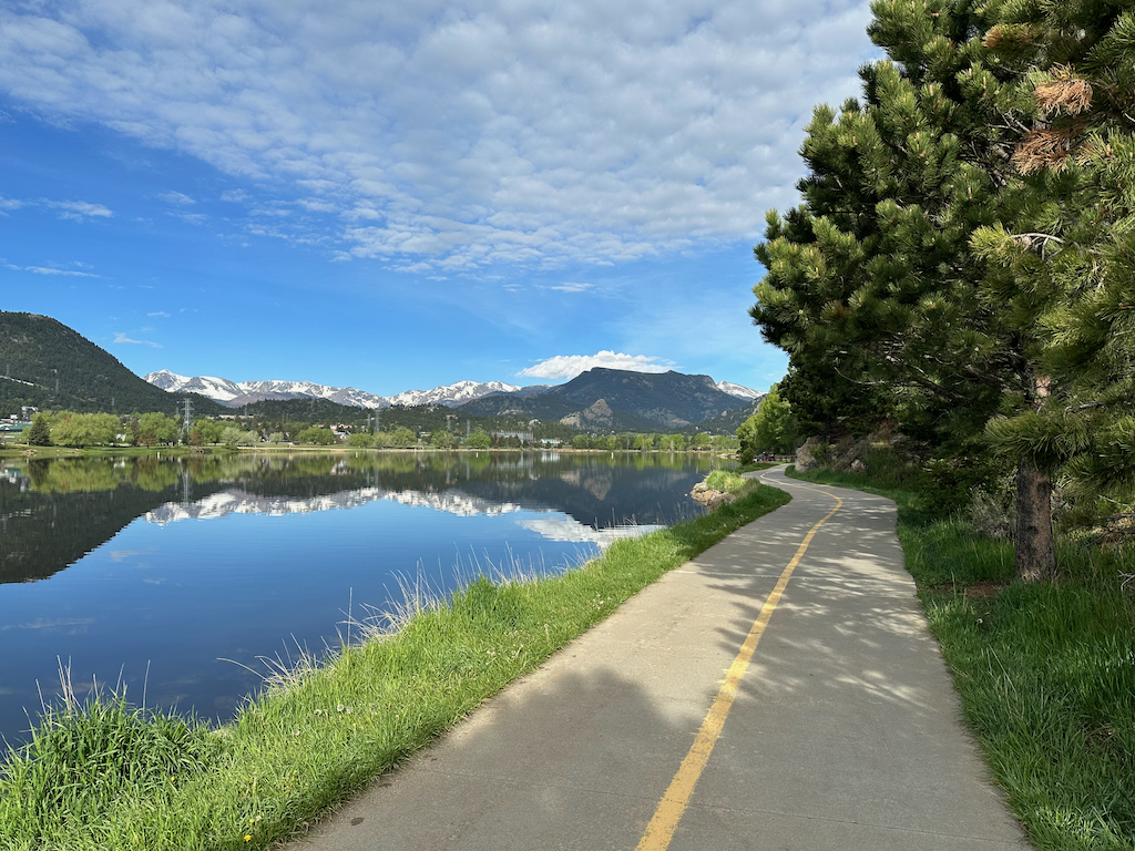
Lake Estes
The scenic byway begins just south of Lake Estes, which is a beautiful man-made reservoir that many locals and tourists flock to for exercise and water activities like kayaking, stand up paddle boarding, and fishing. It’s also a great place for wildlife viewing where you can check out elk, bald eagles, and more.
Related: Discovering the Beauty of Lake Estes: A Guide to Scenic Trails and Wildlife Encounters
Lily Lake and the Twin Sisters Trailhead
Part of Rocky Mountain National Park, Lily Lake is located right off Highway 7. It is part of the timed entry system so during certain hours you’re unable to make a visit unless you have a permit. It’s a small but idyllic lake with easy and moderate hikes and it’s a great place to look for paedomorphic tiger salamanders.
Right next to Lily Lake, on the other side of the highway is the Twin Sisters Trailhead. Taking the trail up to the peaks would be a strenuous adventure for someone on a casual road trip but the peaks themselves are still beautiful to admire. Keep in mind all of these parts are within the Rocky Mountain National Park boundaries so drones are off-limits.
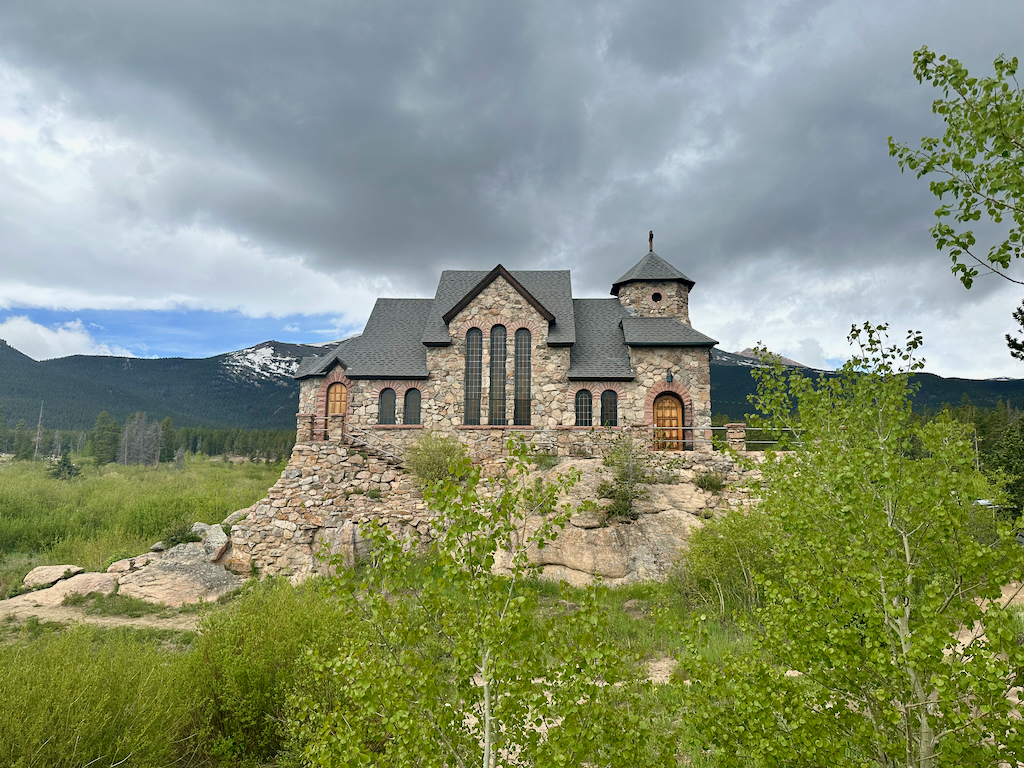
Saint Catherine’s Chapel on the Rock
Saint Catherine’s Chapel on the Rock is undeniably one of the most sought-after attractions along the scenic byway. Perched gracefully on rugged rocks, this exquisite chapel offers a picturesque view with the formidable Longs Peak towering in its backdrop.
In the year 1916, Monsignor Joseph Bosetti drew inspiration from the timeless Biblical phrase “upon this rock I will build my church,” igniting a vision to construct a divine place of worship atop a rocky outcropping. However, it would take until 1936 for the realization of this dream to manifest in the form of the completed church.
Throughout its existence, this sacred sanctuary has withstood the ravages of fires and floods, emerging resilient and steadfast. Over the years, it has welcomed numerous esteemed visitors, including Pope John Paul II.
Entry into the chapel is offered at no cost, and I highly recommend taking a few moments to step inside and marvel at the exquisite architecture. However, it is important to bear in mind that this is not merely a monument but a living place of worship. As you enter, I kindly urge you to do so with reverence and respect, honoring the sanctity of the chapel and its spiritual significance.
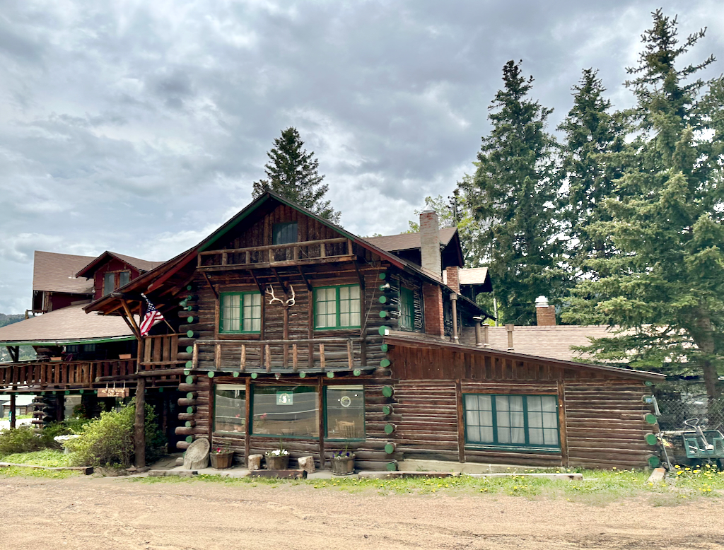
Allenspark
Take a moment to drive through the old mining town of Allenspark, at an elevation of 8,428 feet. Formerly a place where international ski jumping competitions were held, this town once made up primarily of farmers and miners eventually started to cater towards tourism.
Check out the historic Allenspark Lodge B & B, built back in the early 1930s to give you a feel of what the town looked like back in that time.
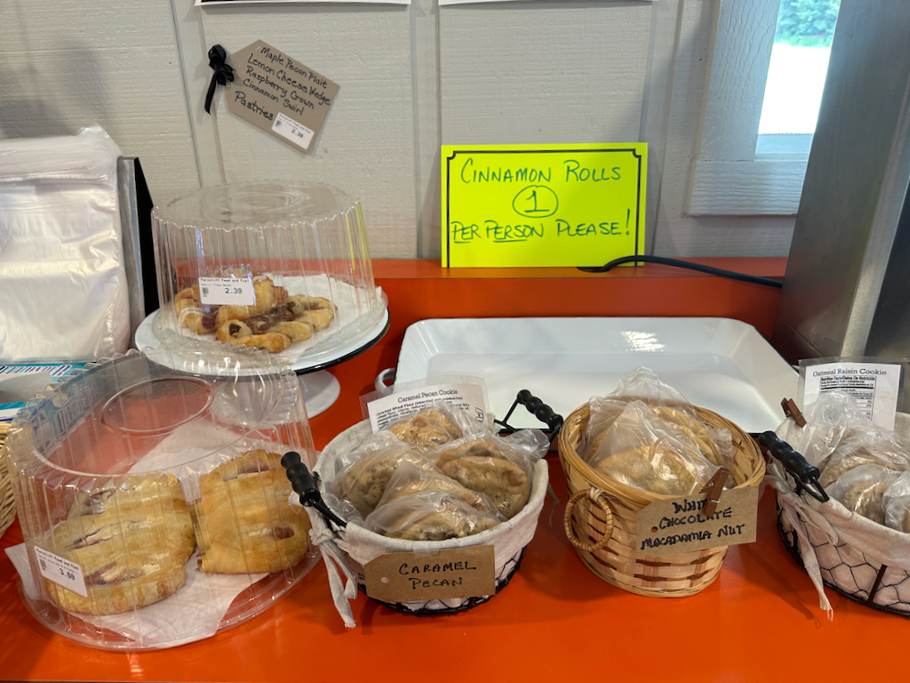
Ferncliff Food & Fuel
After reaching Allenspark, take a moment to visit Ferncliff Food & Fuel.
It’s an excellent spot to refuel for your journey, and they have gained a reputation for their delectable cinnamon buns, although you might need to arrive early to secure one. They go quick and we missed out! In the event that they are sold out, you can opt for their assortment of cookies or explore their highly acclaimed freshly baked goods, including pies.
Brainard Lake Recreational Area
If you’re wanting to do a little bit of hiking among a beautiful area then the Brainard Lake Recreational Area is a good choice. They have several short hikes that take you to stunning lakes at the base of the Rocky Mountains like Long Lake and Mitchell Lake.
If you want to visit, look into getting a parking reservation a couple of weeks ahead of time.
Ward, CO
Just outside of Brainard Lake Recreational Area, who is the small town of Ward, CO. A former mining settlement, it was one of the richest towns in the state during the Colorado gold rush. During World War II, the town was almost completely empty with a year-round population not even big enough to field a basketball team’s starting five although it rebounded during the 60s as it attracted hippies.
But this place may not appeal to everyone. Uninviting signs, shuttered establishments, and deserted vehicles scattered along the roadside create an almost apocalyptic ambiance as you venture through this town situated at an elevation of nearly 10,000 feet with a population of only around 130. I wouldn’t suggest lingering here for too long, but it’s certainly one of the more distinct towns you’ll encounter.
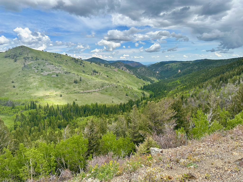
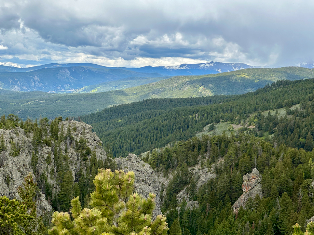
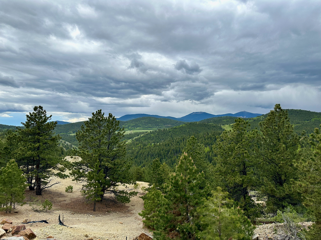
Scenic overlooks between Ward and Nederland
There’s a few really nice view points located between Ward and Nederland. Signs don’t always give you the heads up about the great views ahead and so just be on the lookout on both sides of the highway and you’re surely see some turn out points.
Caribou Ranch Recording Studio
As you begin to approach Nederland, you won’t be far from the former site of the Caribou Ranch Recording Studio. Part of the Colorado Music Hall of Fame, this was one of the hottest recording studios back in the day. Big-time artists like the Beach Boys, Chicago, Michael Jackson, and many more recorded iconic records here including Elton John’s Caribou.
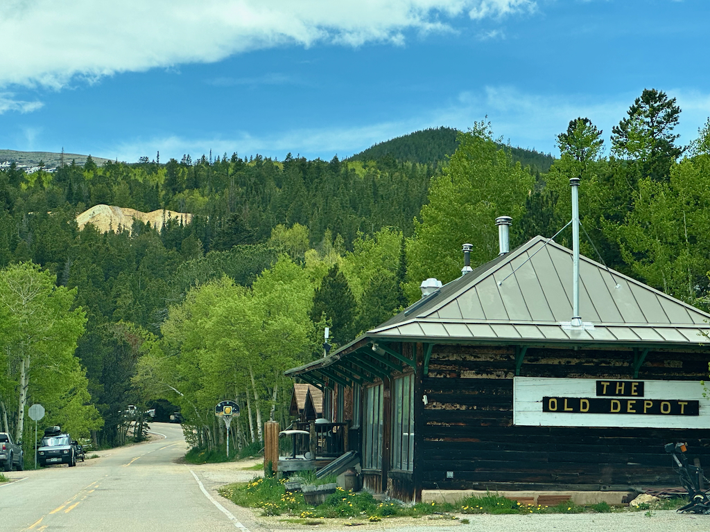
Nederland
Nederland is one of the major cities along the Peak to Peak Scenic Byway. If you plan on stopping somewhere for a little bit and exploring or grabbing something to eat this would be a good place.
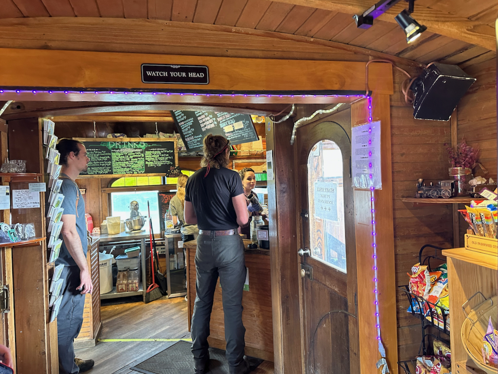
You can visit the Nederland Mining Museum or, if you’re feeling nostalgic, the historic Carousel of Happiness with its hand-carved animals that will transport you back to the early 1900s. Next to the carousel, at The Train Cars, you can enjoy some miniature donuts in a unique train car or even go for a coffee or kava cocktail.
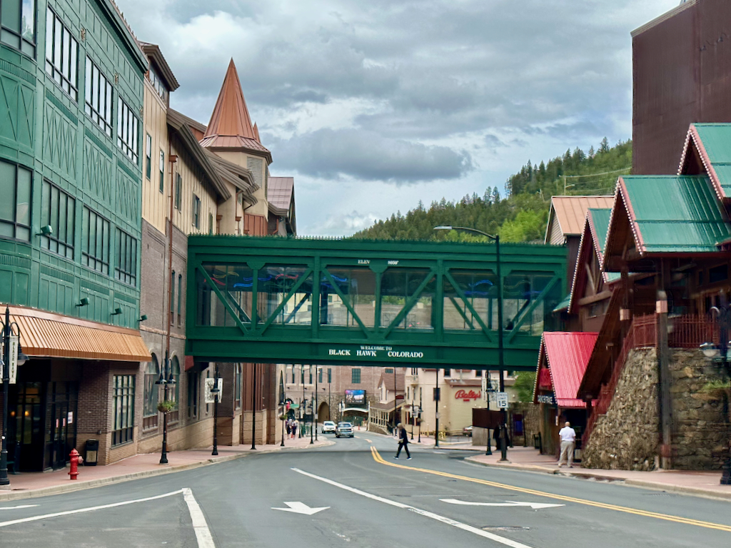
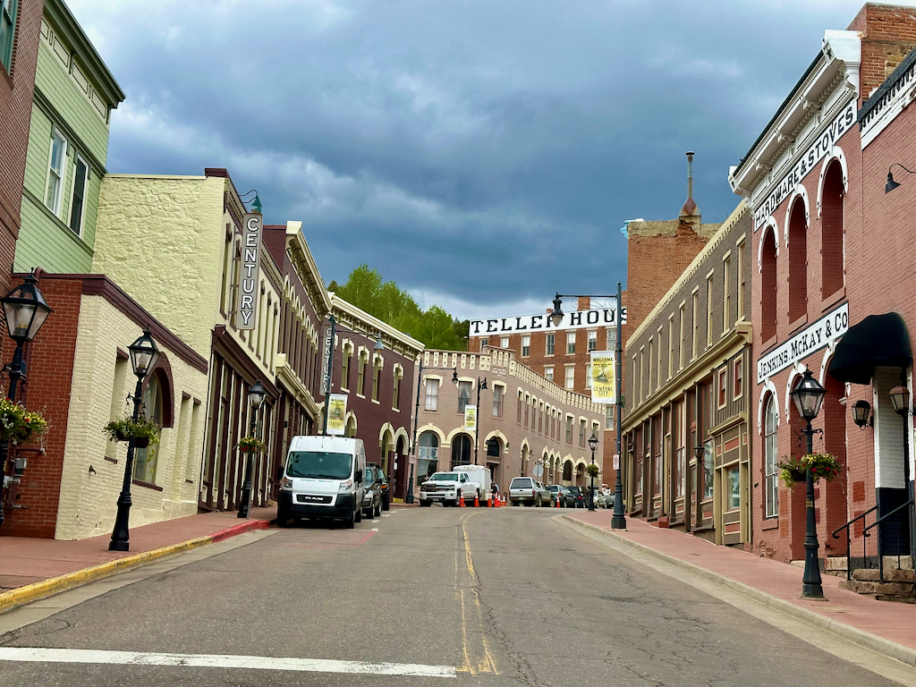
Blackhawk
While there may be varying opinions on where the official end of the scenic byway lies, some regarding Blackhawk and others pointing to Interstate 70, I personally align with the latter as the final point.
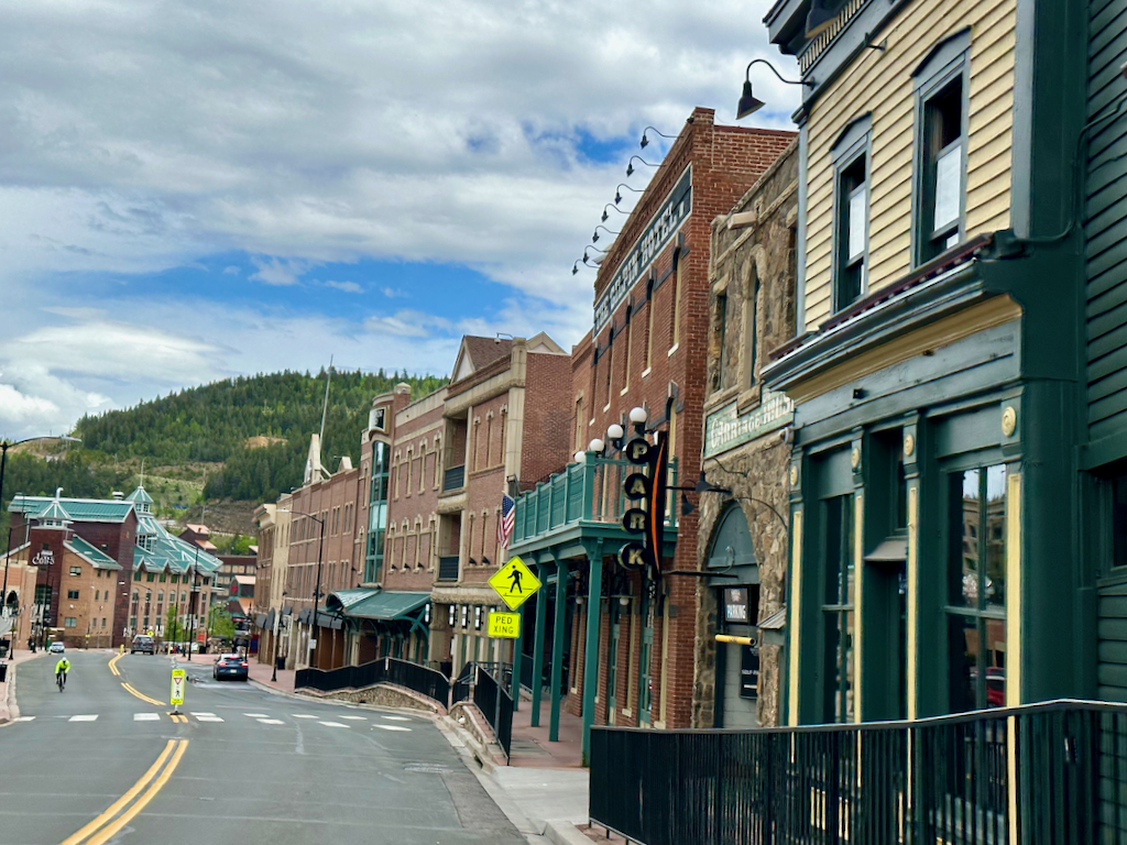
However, regardless of this distinction, Blackhawk is a captivating city with a notable casino presence, characterized by towering high-rise and mid-rise structures that line its streets.
Similar to many towns in the region, Blackhawk holds the historical significance of being a mining settlement dating back to 1859. As a part of the Central City/Black Hawk National Historic District, its rich past is deeply intertwined with the mining industry and it was once known as the “Richest Square Mile on Earth.”
Although the town faced a decline throughout much of the 20th century, it experienced a remarkable resurgence when casinos were established in the early 1990s. These new ventures breathed new life into Blackhawk, revitalizing its economy and attracting visitors from far and wide.
Central City
Central City is often regarded as a sister/rival town to Blackhawk, as they are located in close proximity to each other and are casino competitors.
When traveling from the north, Blackhawk is encountered first, while coming from the south, one would reach Central City initially.
This arrangement was intentionally designed with the construction of the Central City Parkway, an infrastructure project aimed at enhancing Central City’s competitiveness with Blackhawk.
By strategically positioning Central City as the first point of arrival for travelers from the south, the town was able to establish its presence and attract visitors to its own unique offerings and attractions.
Central City offers more of a rustic and historical experience as they have not allowed the large mid-rise and high-rise buildings to be built, giving it more of a unique historical charm compared to Blackhawk.
There are a few museums to explore here, the beautiful Central City Opera House, old Belvidere Theatre, and if you enjoy gold panning, you might want to consider visiting Hidee Gold Mine Tours and Panning.
The good news is that if you want to experience both of these competing cities, you can get between them for free with the Black Hawk & Central City Tramway.
Past Blackhawk and Central City, there’s another nice look out.
Soon you will encounter Interstate 70 and the enchanting town of Idaho Springs, which, in my personal estimation, is the conclusion of this scenic byway but others disagree.
Ghost towns near the Peak to Peak Scenic Byway
While some of the historic mining towns may feel like a ghost towns, there are true ghost towns located within reach of different segments of the Peak to Peak Scenic Byway.
Often, you need to venture into a side road which may be a dirt road and some may require 4 x 4 capabilities to get where you need to go. During the winter, some of these may not be accessible so always do your research to make sure you are safely exploring these remote areas.
At these ghost towns you may find ruins or sometimes preserved structures from the old mining days but be warned some have lone residents so proceed with respect/common sense when visiting these.
Here are a few of the ghost towns to look into.
- Caribou: 4768-4898 Caribou Rd, Nederland, CO 80466
- Nevadaville: 1040 Nevadaville Rd, Central City, CO 80427 (some residents still there)
- Russell Gulch
- Ghost town off Apex Valley Rd
Final word
The Peak to Peak Scenic Byway is a beautiful highway that is fun to take when traveling to or from Estes Park, Colorado. I like it because it’s not too long and gives you just the right amount of length so you can complete it in a reasonable amount of time while still exploring some of the old mining towns and stopping off at beautiful overlooks.
Daniel Gillaspia is the Founder of UponArriving.com and the credit card app, WalletFlo. He is a former attorney turned travel expert covering destinations along with TSA, airline, and hotel policies. Since 2014, his content has been featured in publications such as National Geographic, Smithsonian Magazine, and CNBC. Read my bio.
