Saguaro National Park West District does not have as many trails or as high of peaks as the East District. But it does offer more accessible summits and the highest peak in the West District/Tucson Mountains is Wasson Peak. You can get there a few different ways but in this article, I will review the Wasson Peak via King Canyon and Hugh Norris Trail.
Table of Contents
Wasson Peak Trail Overview
There are a handful of ways to get to Wasson Peak but this review will focus on the Wasson Peak via King Canyon and Hugh Norris Trail, which is a moderate-to-difficult loop trail just under 8 miles with an elevation gain of 1,847 feet.
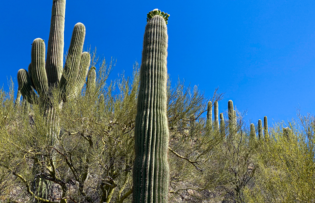
This is a perfect hike for a rewarding summit that offers exceptional views throughout the hike, up-close encounters with saguaros, and plenty of wildflowers in spring. Much of the trails are rocky which adds to the difficulty of the hike but overall the hike is pretty manageable and one of my favorites.
- Distance: 7.8 miles
- Elevation Gain: 1,847 feet
- Route Type: Loop
- Pets: No
- Difficulty: Moderate to difficult
Tip: Use WalletFlo for all your credit card needs. It’s free and will help you optimize your rewards and savings!
Getting to the trailhead
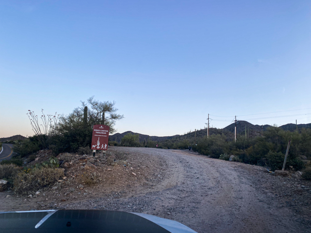
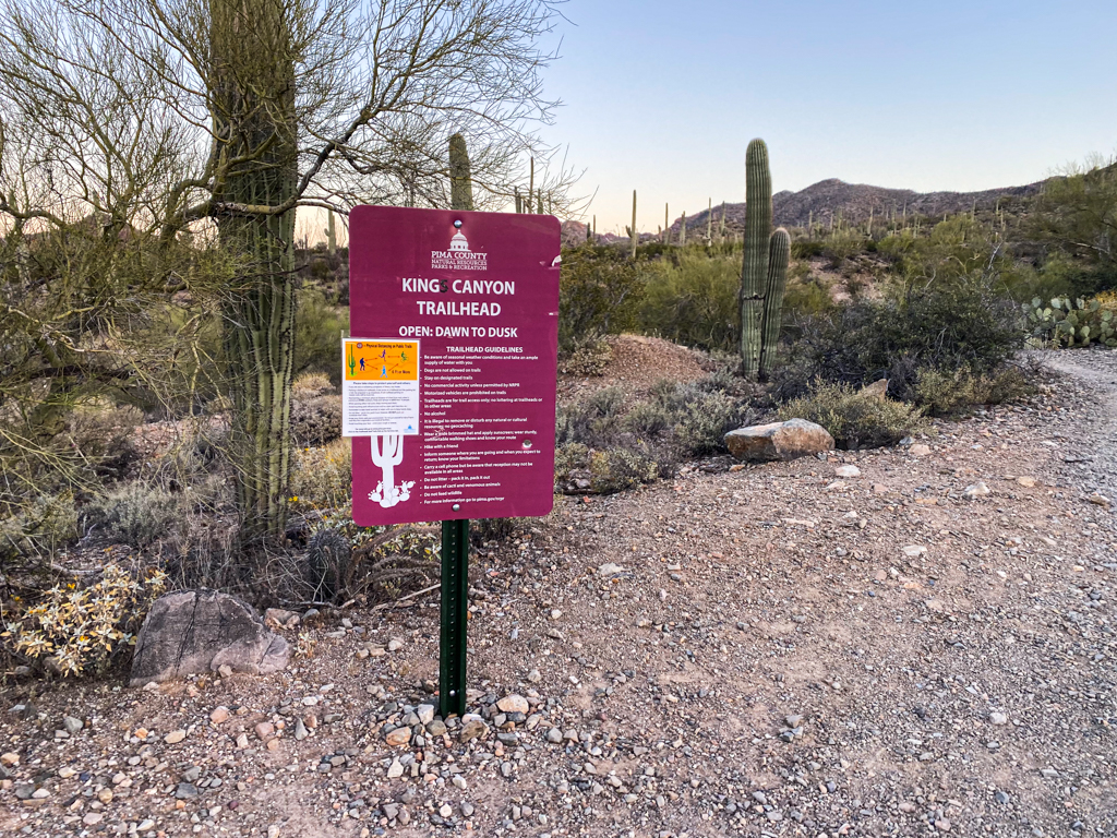
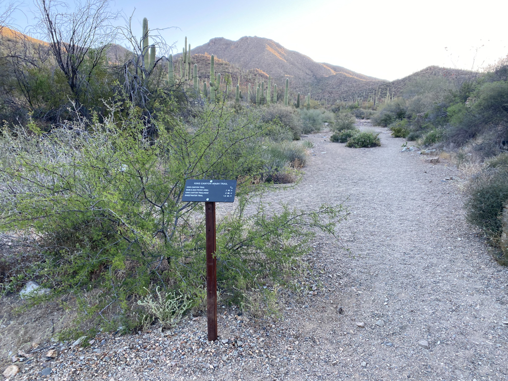
You will start off this hike from the King Canyon Trailhead which is located in the southern end of the Saguaro National Park West District.
While you do need to pay a fee to enter the park, I did not see any place for you to pay that fee to enter this trailhead.
You will clearly see the turning point for the parking lot as you approach from N Kinney Road. (The trailhead is located right next to the Sonoran Desert Museum.)
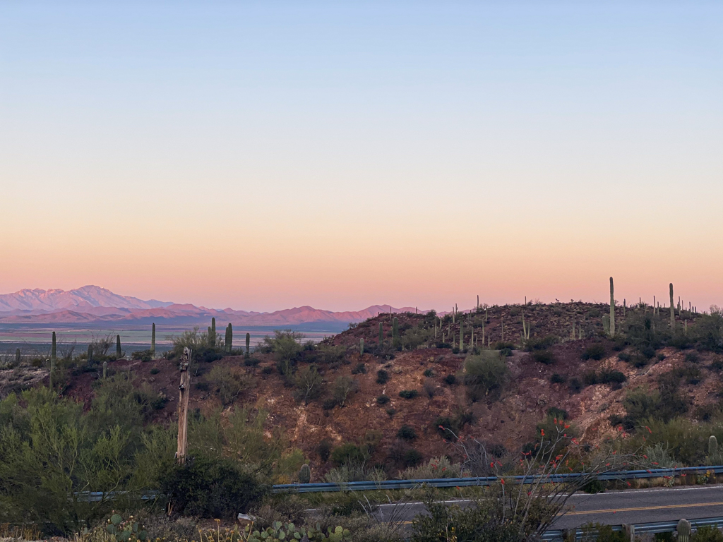
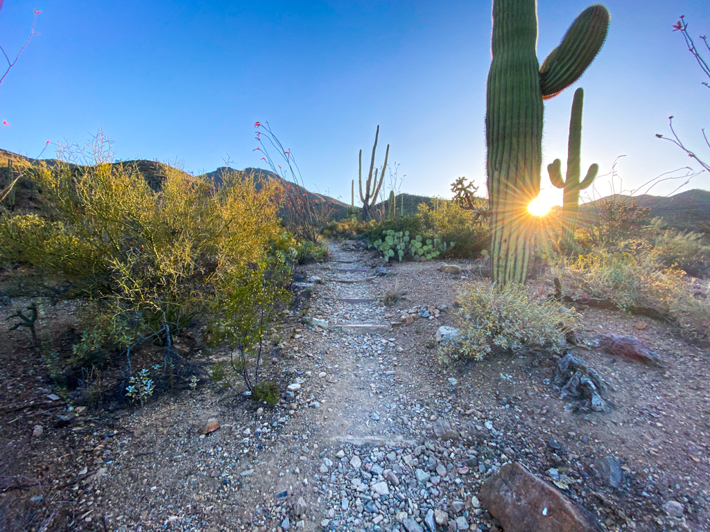
We arrived at 6 AM which was about 15 minutes after sunrise (in late April) and I think it was the perfect time. This allowed us to avoid direct sun exposure for a large part of the ascent and we also had a great deal of shade on the way down.
Considering this was late April and temperatures were starting to rise during the day, it was a very mild hike in terms of temperature. Plus, the early morning views are breathtaking.
Trail conditions
The trails are well-maintained and easy to follow throughout the entire hike.
There are just a couple of issues.
First, one of the signs towards the beginning of the hike could confuse someone if they didn’t have a GPS (more on that below).
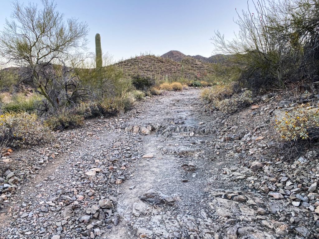
Second, a large portion of this hike is very rocky. I’m not a huge fan of hiking along super rocky paths because it feels like a twist of the ankle is always right on the horizon and the threat only becomes worse the more tired you get.
Some of the paths are not as bad but it’s definitely something to be mindful of.
Route description
As stated, you will start the hike at the King Canyon trailhead.
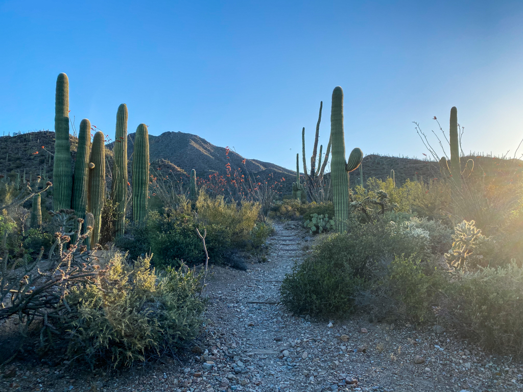
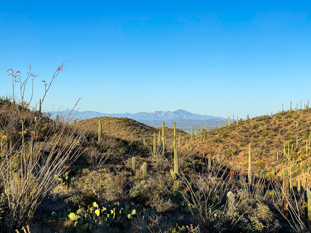
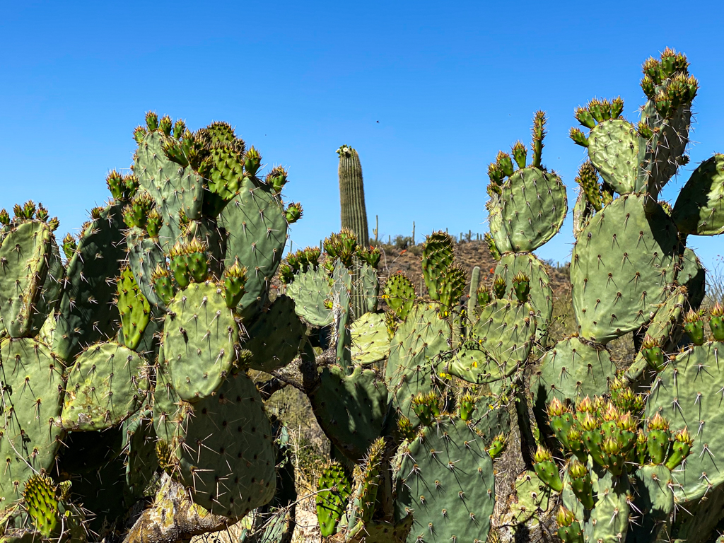
The first part of the hike is a gradual ascent and you will soon find yourself looking out into the canyon with some great views.
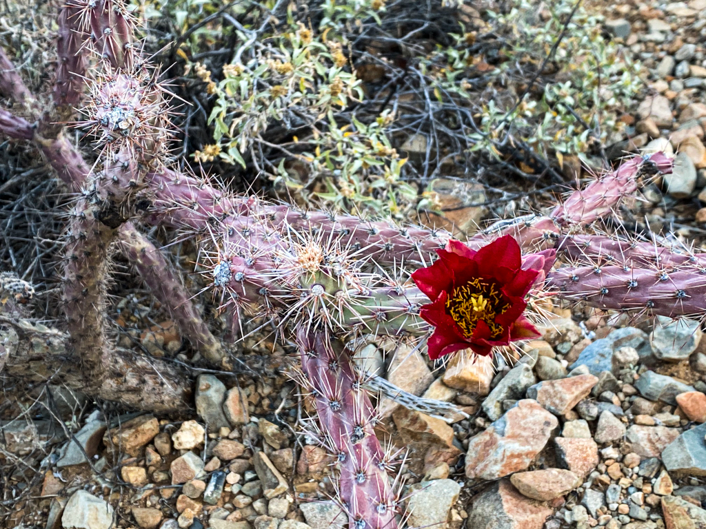
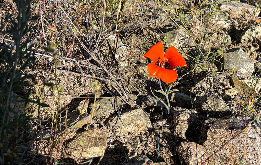
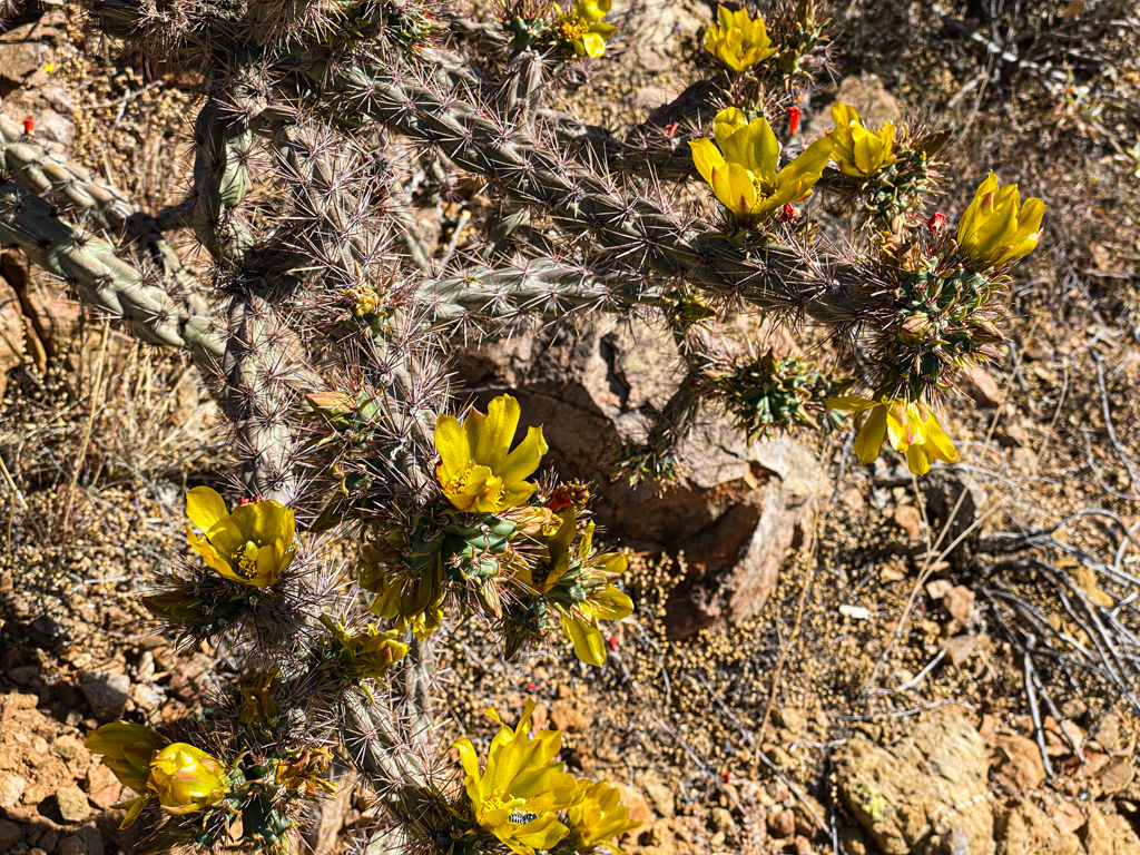
I immediately noticed some blooming chollas that I had not seen before on any of our previous hikes.
I enjoyed the mild incline and great views during this portion of the hike and since we started early we were in the shade the entire time.
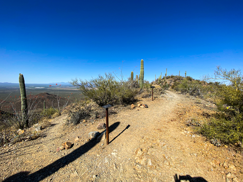
At just under 1 mile into the hike you will encounter a sign that is confusing with its orientation. It looks like it is pointing you a different way for the King Canyon trail but just keep going along the path you were heading on and if in doubt check your GPS.
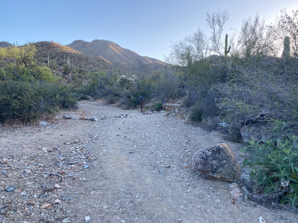
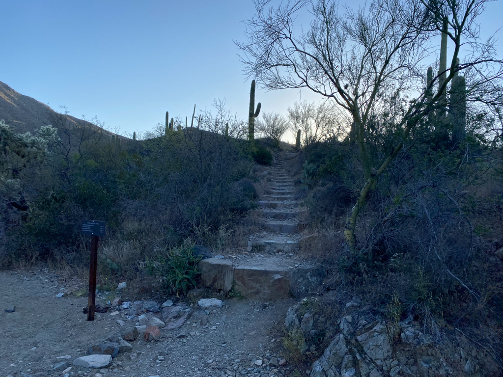
Shortly after this sign, you will come to another fork in the trail but this one is pretty clearly marked.
You will see rocks blocking off the path on the right and there will be a sign pointing you up a staircase which is where you need to head up.
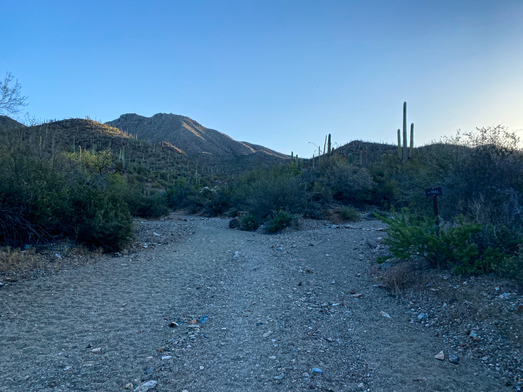
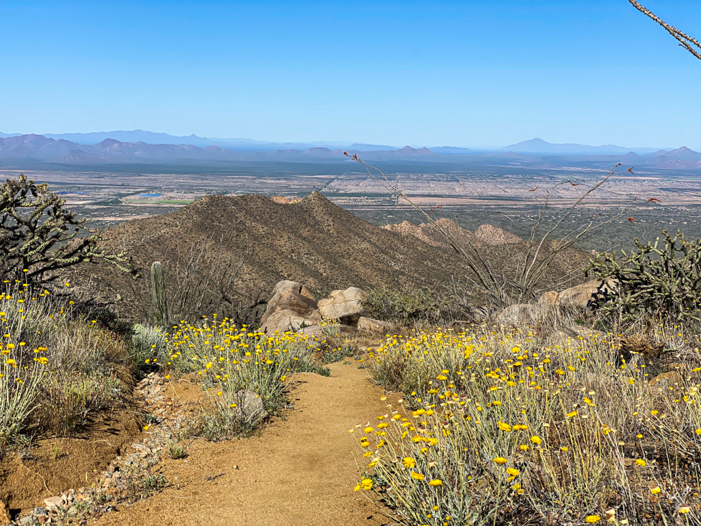
For the next mile, things will continue to be pretty mild in terms of incline and so it is another great opportunity to just enjoy the scenery which is fantastic on this hike, especially in the morning just after sunrise.
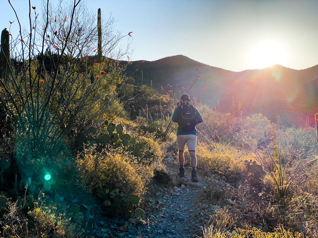
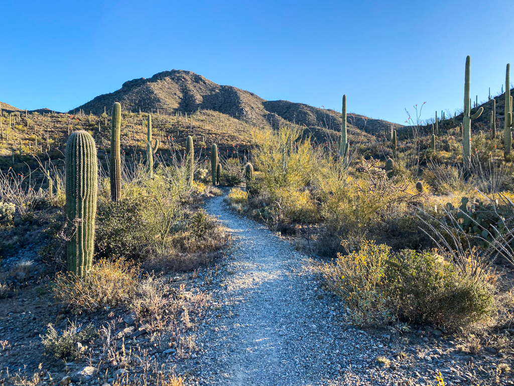
Once you get to about the 1.6 mile marker, you’ll start to notice the incline picking up as the views become better and better.
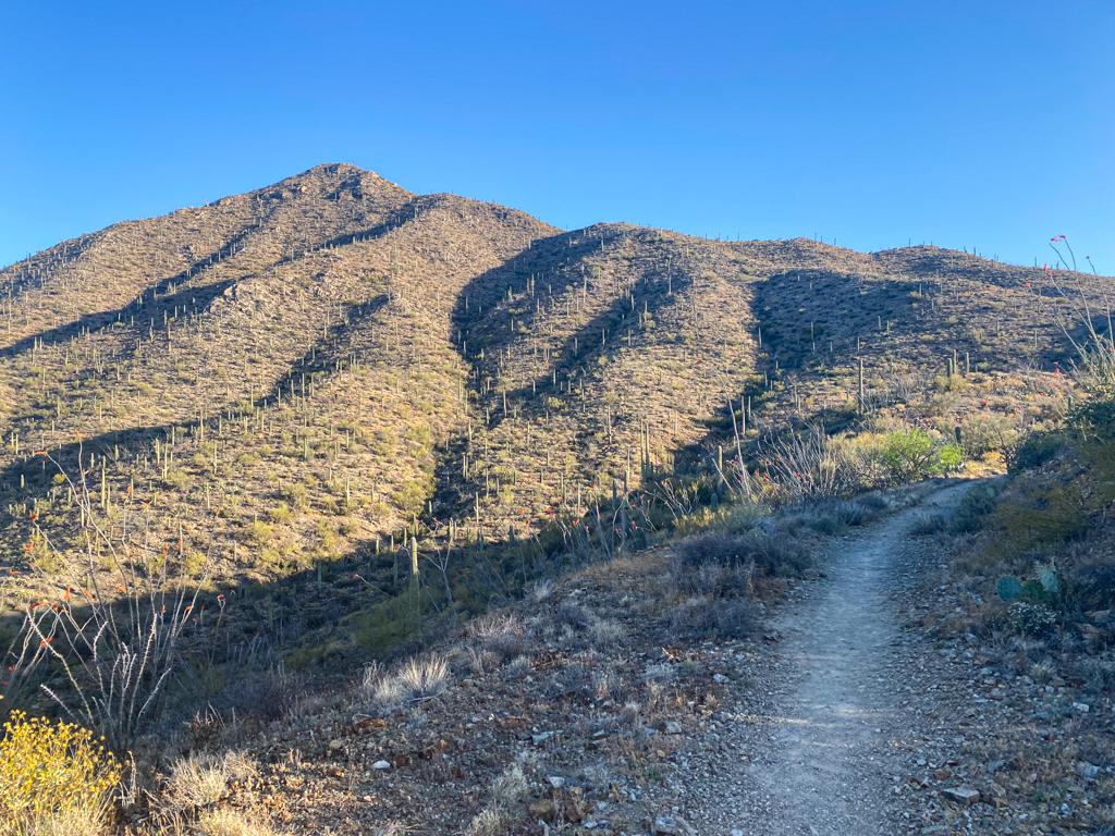
Then, after you reach about 2 miles into the hike this is when the incline becomes more of a challenge.
Unfortunately, during the hike I started to get a little bit sick feeling perhaps from chugging way too much water at the start of the hike so this portion of the hike was more challenging than it probably would normally be.
If you are very fit then you will probably just enjoy the work out but if you have not developed a lot of endurance or stamina then the incline and switch backs will prove to be a challenge.
There will be a few places to sit and take a break along the switchbacks so just pace yourself and take a couple of breaks if necessary.
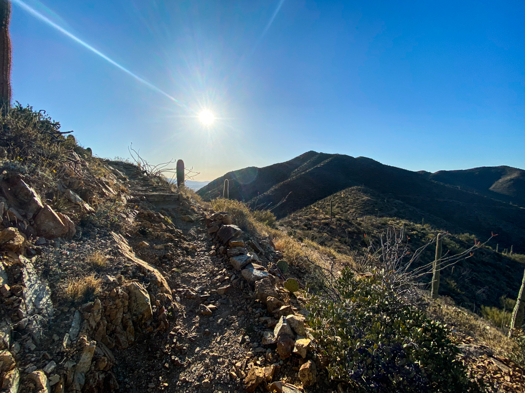
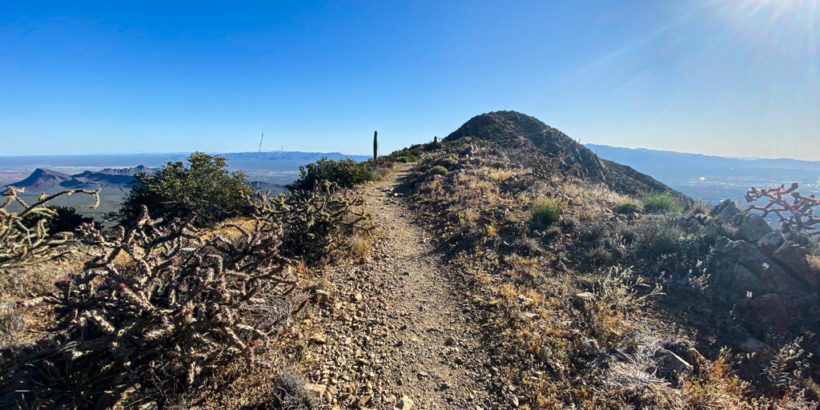
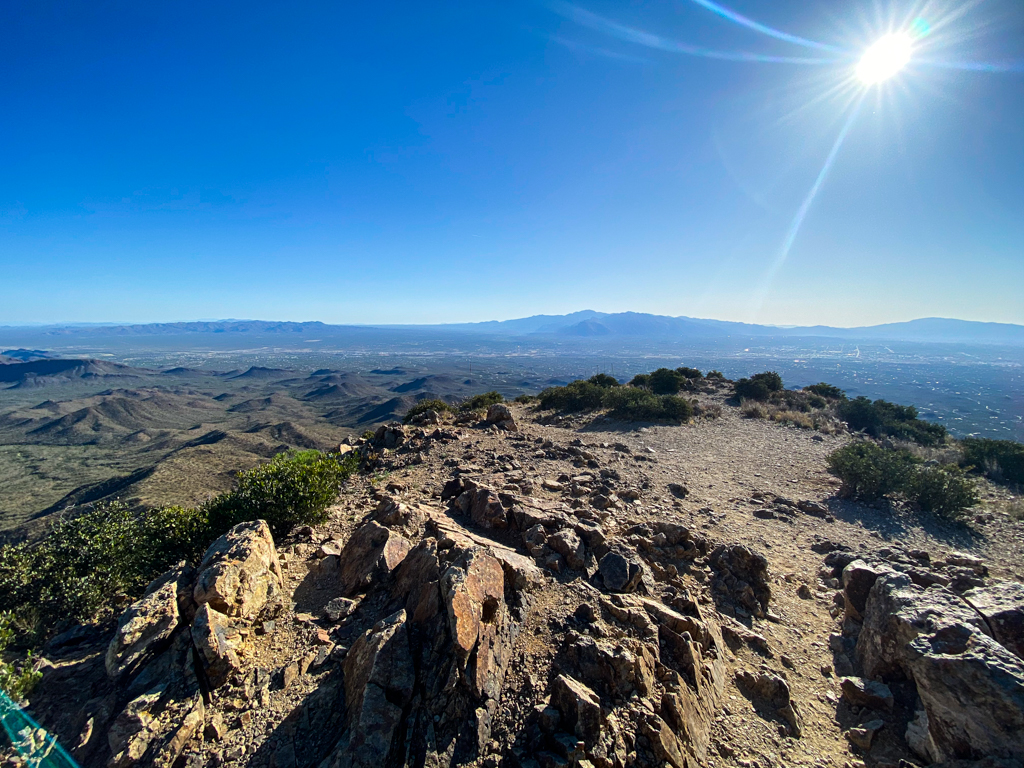
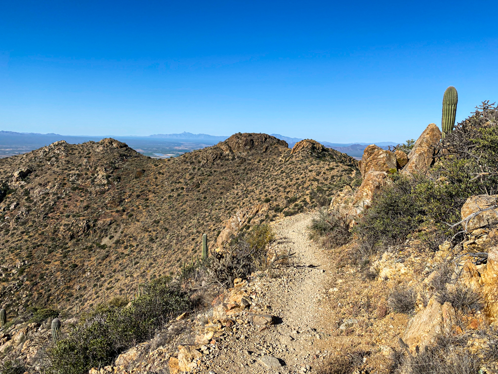
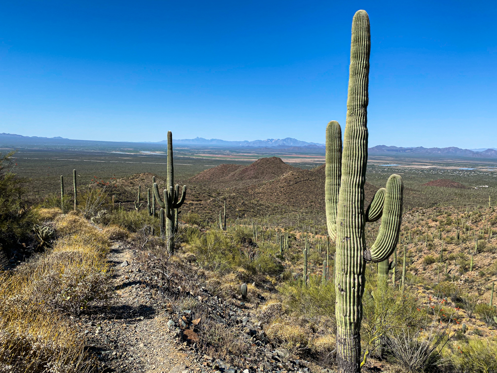
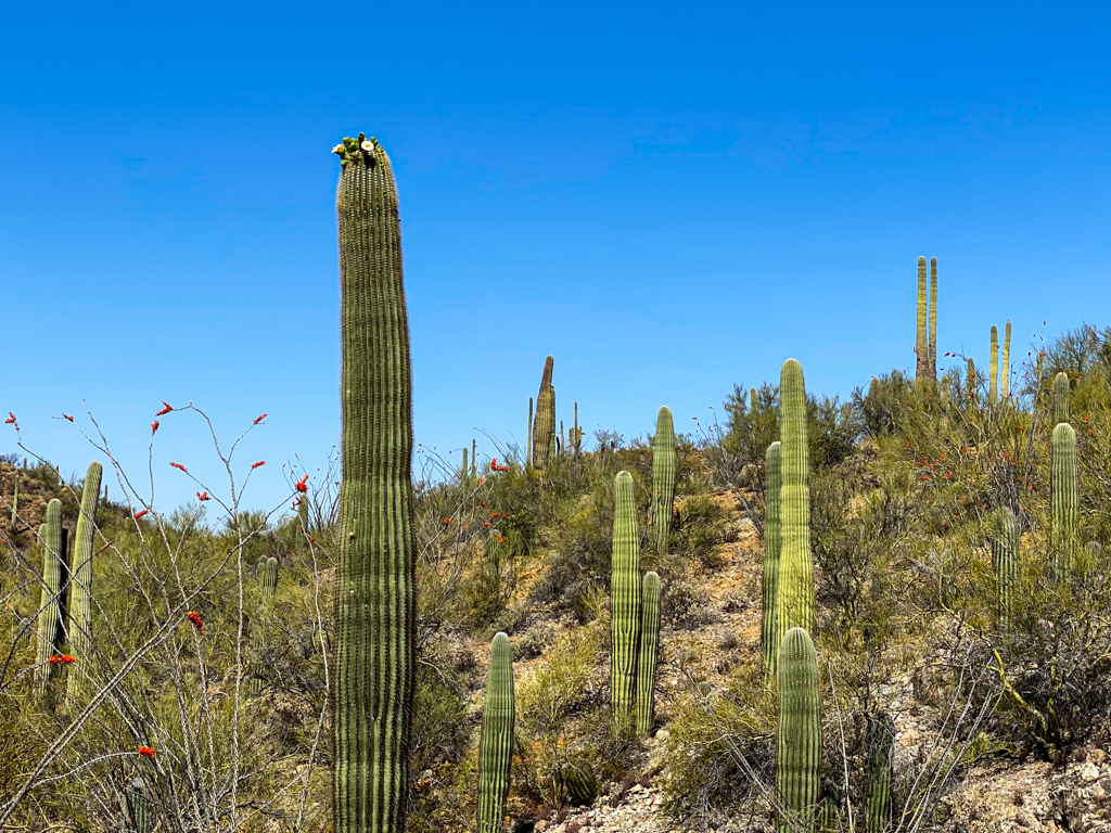
But after you head up about one mile of the most challenging stretch of the hike, the view will open up on top of the ridge and you will see Wasson Peak in front of you in glorious fashion.
You just need to make your way through the slightly meandering trail at this point and deal with a little bit more of an incline that wraps around the peak and then you will find yourself at the top of the summit!
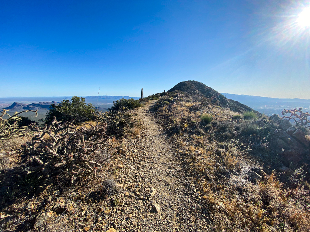
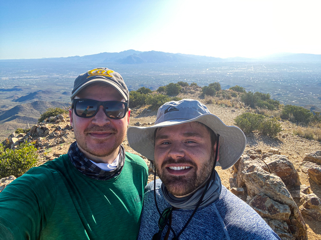
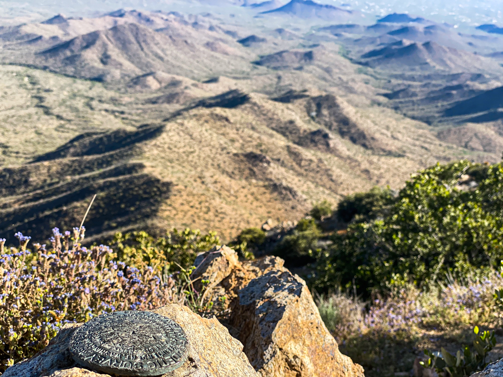
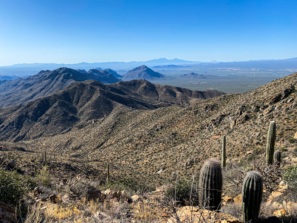
The summit offers you complete 360° views of the surrounding area and mountains. It’s a pretty beautiful site up there and there is plenty of room on top to sit around and recharge.
Since we started early, we had the summit all to ourselves. (Well almost to ourselves, there was a little bunny hopping around at the top.)
Be sure to look for that U.S. Coast & Geodetic Survey marker.
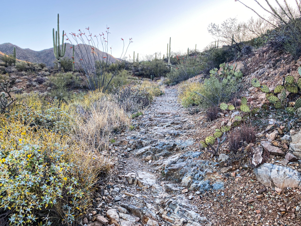
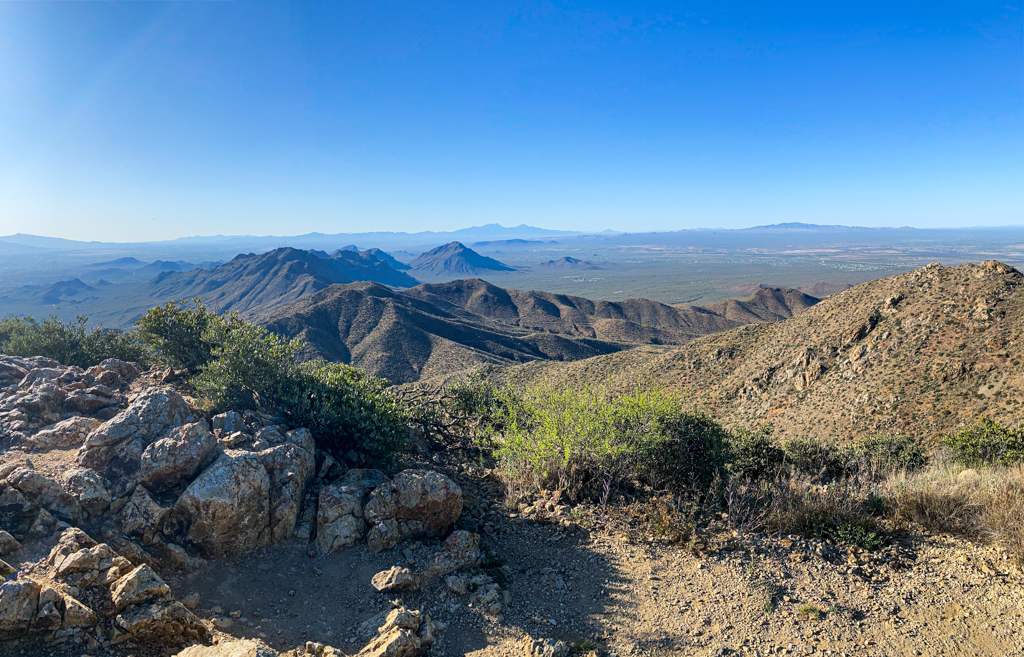
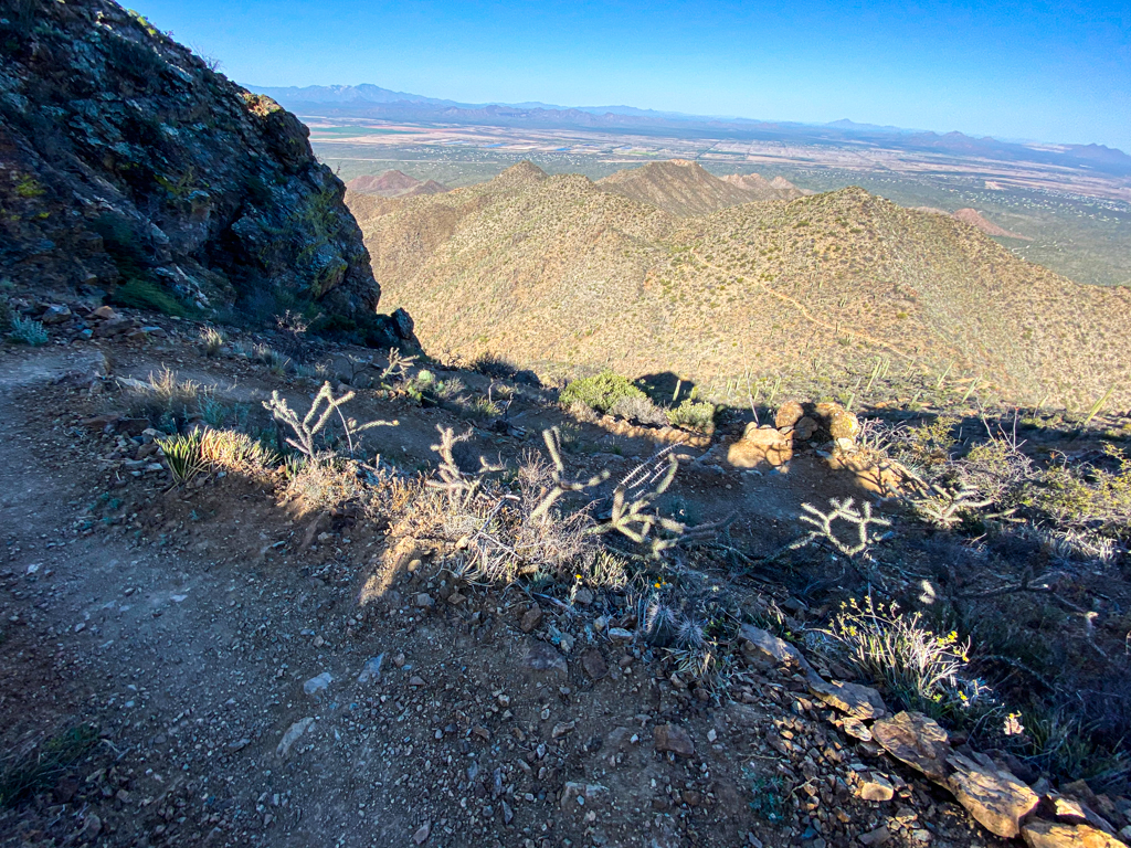
After you spent some time recharging and enjoying the views, it’s time to head down the beautiful Hugh Norris Trail, which will drop you down by about 900 feet.
If you headed out early enough, you should have shade on this trail for a large portion heading down.
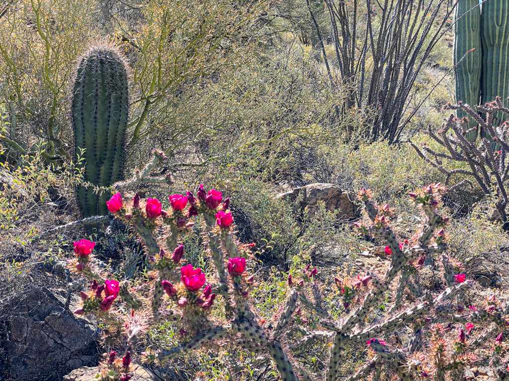
This trail follows along the ridge and offers fantastic views as you make your way down — it was my favorite stretch the hike.
You’ll start off with some gradual and longer switchbacks to make your way down but a lot of it is just a steady straightforward decline.
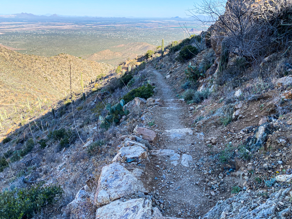
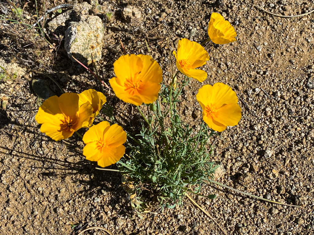
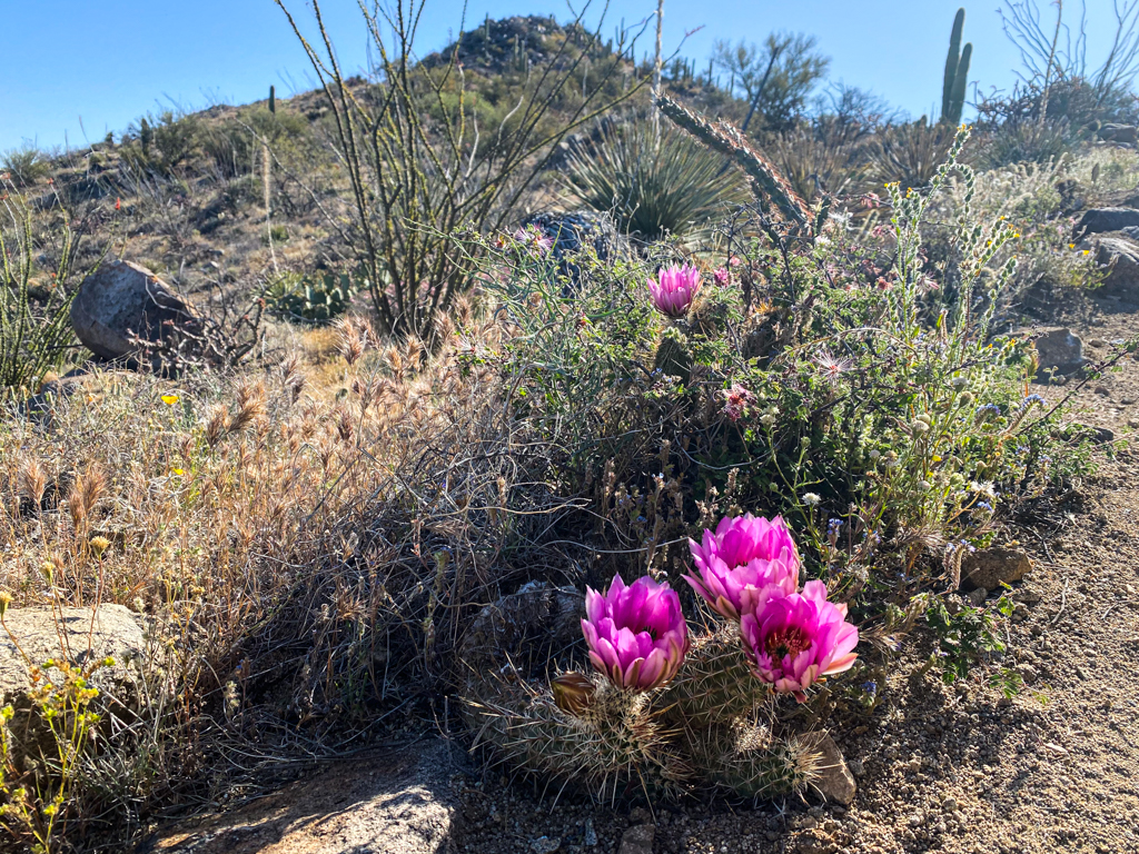
There were also tons of wildflowers on this route along with dozens and dozens of lizards. The wildflowers spotted here compared with the beautiful Hope Camp, Coyote Wash, and Ruiz Trail Loop, which had a pretty impressive display.
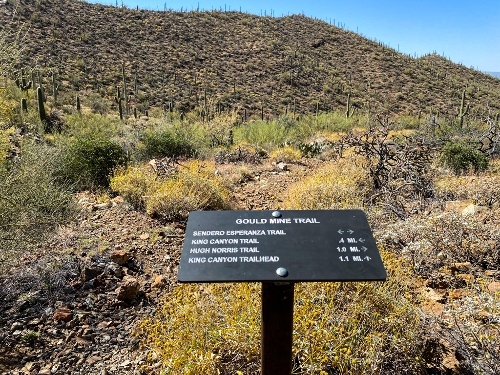
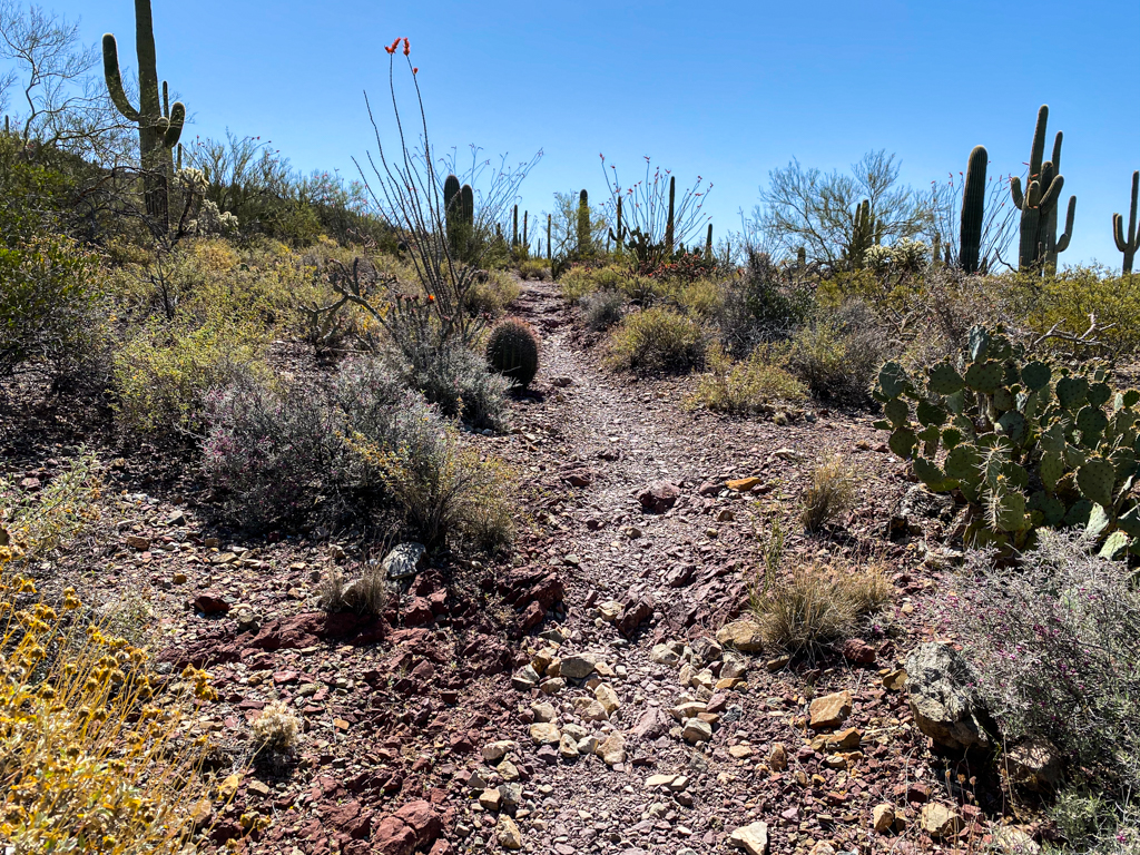
About 5.8 miles in the hike you will have descended about 1,000 feet and you will come across a trail juncture with three different paths. You will want to take the trail on the left which is the Sendero Esperanza Trail.
Follow that trail for downhill about 450 feet for just under 1 mile, passing up old copper mines and a stone cabin and perhaps some more wildflowers.
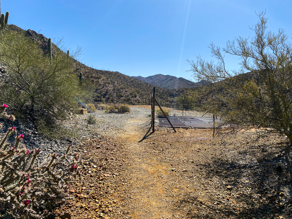
Then you will head southwest on the Gould Mine Trail. At that point, you only have about 1 mile left in the hike.
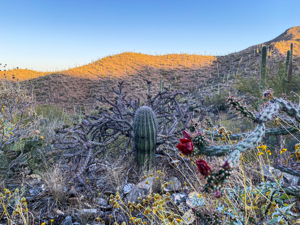
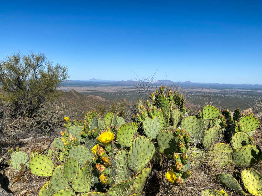
The Gould Mine Trail had a high concentration of blooming cactuses which was pretty impressive.
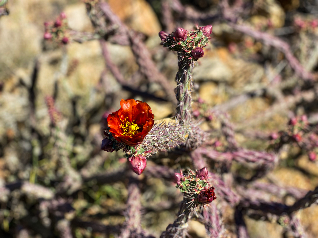
It also had some portions with maroon and purple-ish rock which was pretty cool to see.
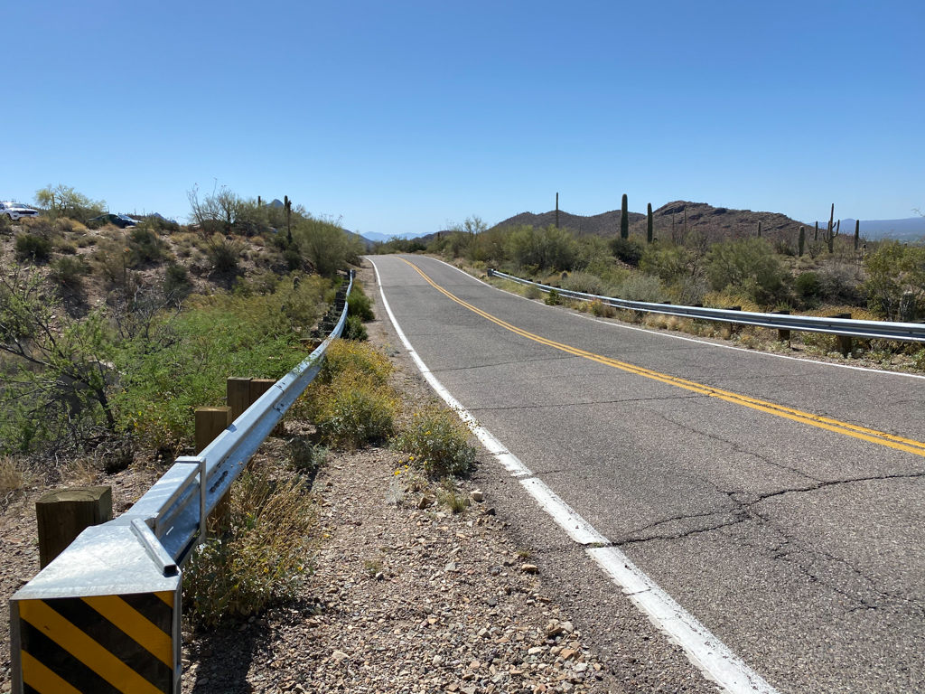
To finish off the hike we had the choice to head down into a wash or to simply get on N Kinney Road for a little bit and make our way to the parking lot and we opted to walk along the roadside.
Final word
Overall, this hike really had it all. Impressive views, close encounters with saguaro cactuses (including some in bloom), tons of wildflowers, and a rewarding summit. The only major drawback to the hike was that so much of it is along rocky trails and that can get a little old real fast.
Daniel Gillaspia is the Founder of UponArriving.com and the credit card app, WalletFlo. He is a former attorney turned travel expert covering destinations along with TSA, airline, and hotel policies. Since 2014, his content has been featured in publications such as National Geographic, Smithsonian Magazine, and CNBC. Read my bio.
