If you’ve ever done a road trip through the southwest and driven through New Mexico you’ve probably noticed safety corridor signs along the highway.
As someone who lives in Arizona and constantly goes on road trips through New Mexico, I’ve certainly noticed them all over the state.
But what exactly do the signs mean and what do you need to know about them?
In this article, I will break down exactly what these safety corridors are and provide you with all of the information that you need to know about them.
What is a New Mexico safety corridor?
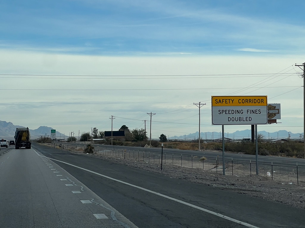
A safety corridor is a stretch of highway that has been deemed to have an increased risk of traffic accidents. In these zones, penalties for violating traffic laws increase.
For example, in New Mexico you may have to pay double the traffic fines for violations such as speeding, texting while driving, driving under the influence (DUI), failing to indicate a lane change, etc.
Another characteristic of these corridors is that they have a zero tolerance policy for infractions.
So if you’re the type of person who often gets lucky with law officers and gets off with a warning, that probably will NOT happen if you get pulled over in a safety corridor.
It’s also possible that you might notice an increased presence of highway patrol officers inside a safety corridor. Both state police officers and local officers may play a role in enforcement.
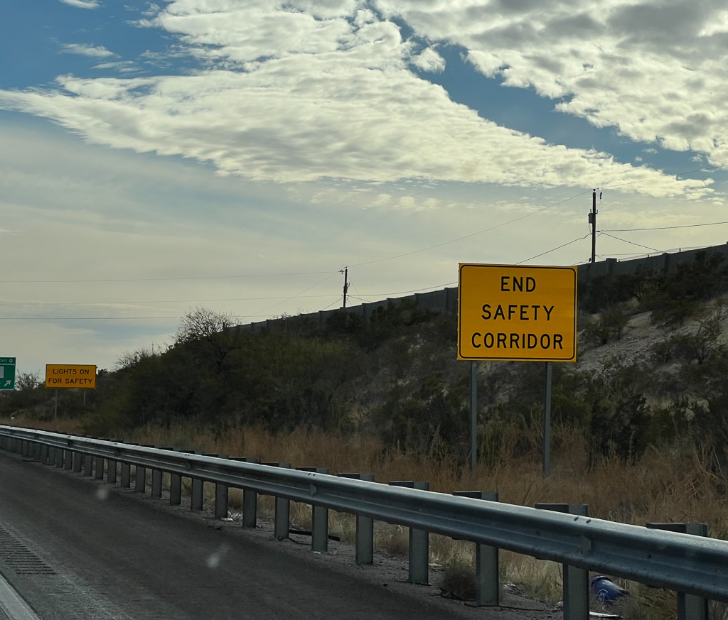
In some safety corridors you might see signs encouraging you to use your head lights. These seem to be optional recommendations and I don’t believe you’ll be ticketed for failing to turn on your lights.
Tip: Use the free app WalletFlo to help you travel the world for free by finding the best travel credit cards and promotions!
Where are the New Mexico safety corridors?
The safety corridor program in New Mexico started around 2002 and as a result you can find the safety corridors in many different regions of New Mexico, including on interstate highways (I-10, I-40, I-25) and also on state highways (NM-128, etc.).
The New Mexico Department of Transportation divides the state into six districts and each district will have recommendations for different stretches of highway that could qualify as safety corridors.
For example, below is an older map of few districts with certain highways marked as higher risk. As you can see, some stretches are in red indicating that they are highest risk while orange and yellow are lower risk.
According to the New Mexico policy, areas with 10 or more injury or fatal crashes per five miles are closely examined and the top 10 to 15 roadways per district are then ranked.
The New Mexico DOT will then work with local officials to get opinions on what should be done and what areas might be impacted the most by designating them a safety corridor. The process then goes through a district engineer and a review of things like signage and equipment.
A public awareness campaign is a part of the process as well.
Related: McGinn’s PistachioLand – World’s Largest Pistachio (New Mexico) Review
An area can be designated a safety corridor based on increased traffic accidents but also other risks like the terrain, weather, increase in drunk drivers, aggressive driving, speeding, and ignoring traffic signs.
Often times, these safety corridors exist where you see a high volume of 18 wheelers. In some instances, truckers might make up close to 80% of the traffic on that stretch of highway.
Since traffic accidents involving automobiles and 18 wheelers can be so much more dangerous, it’s no surprise that these segments of the road make up safety corridors.
Keep in mind that certain stretches of highway may become more or less dangerous as time goes by. Therefore, the safety corridors can change over time.
A safety corridor might be based on the data from the last 3 to 5 years and will probably run for at least three years. After three years, the safety corridor could be “decommissioned.” At that point, another stretch of roadway will likely fill its place.
Keep tabs on the New Mexico Department of Transportation to hear about announcements of new safety corridors.
How to tell if you are in a New Mexico safety corridor
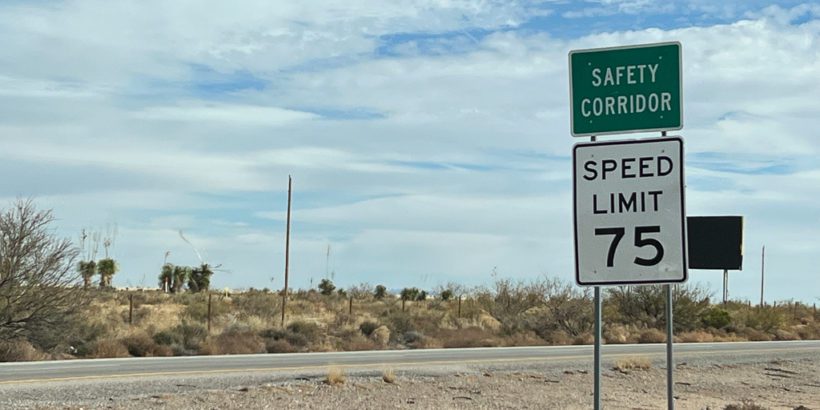
It’s generally pretty easy to tell if you are driving through a New Mexico safety corridor. If you are a reasonably alert driver you should notice the New Mexico safety corridor signs on the side of the road.
Not all of the signs look the same, though.
Some of the signs will be posted on top of speed limit signs but others will be standalone signs.
So you should not look for one specific shape or size but instead focus on the text of the sign.
Also, you should see a sign telling you that you have reached the end of a New Mexico safety corridor.
There is no standard length when it comes to how long a safety corridor is in New Mexico. For example, you could go through one that is a short as 7 miles or 40+ miles.
Typically, you’re probably looking at about 15 miles, though.
States tend to try to avoid having too many safety corridors because they will soon lose their effectiveness if essentially every highway is deemed a safety risk.
Check out: Buc-ee’s Ultimate Guide (Locations & Facts)

Criticisms of the safety corridors
Critics of the safety corridors feel like these are just money grabs for the state.
Basically, the state could set up a safety corridor on a popular commuter route where drivers are regularly driving over the speed limit.
At that point, officers have more justification to issue citations for less egregious offenses than they would outside of a safety corridor. For example, it might be more common to get pulled over when going only five to ten over the speed limit.
On top of that, because the fines can be doubled they are able to generate more revenue.
Regardless of how you feel about the corridors though, the fact is you could be paying double for traffic infractions so it is best to abide by the law as best you can while in these zones.
The big question is do these safety corridors actually work?
The overall goal is to reduce crashes and fatalities on these segments by at least 20% but it’s hard to find recent data that shows if that goal has been met on the various safety corridors.
It’s also worth pointing out that New Mexico is not the only state that has safety corridors.
You can also find them or a close variation of them in states like: Alaska, California, Florida, Kentucky, Minnesota, New Jersey, New Mexico, New York, Ohio, Oregon, Pennsylvania, Virginia, Washington, and others.
Final word
You can find safety corridors in almost every part of New Mexico. They usually have a zero tolerance policy and traffic fines can double so you definitely don’t want to push things when driving through these zones. Also, these can change every few years so you have to keep your eyes open to make sure you know where they currently are.
Daniel Gillaspia is the Founder of UponArriving.com and the credit card app, WalletFlo. He is a former attorney turned travel expert covering destinations along with TSA, airline, and hotel policies. Since 2014, his content has been featured in publications such as National Geographic, Smithsonian Magazine, and CNBC. Read my bio.

In other word, my poor ass state needs more revenue.