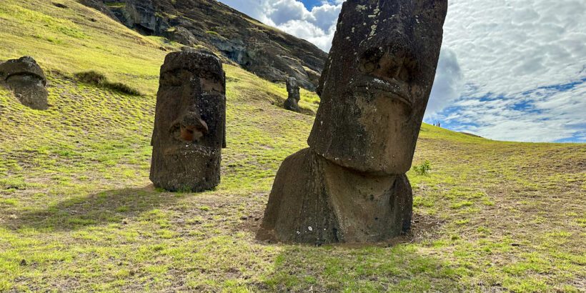
Easter Island (also known as Rapa Nui locally) is one of the most interesting locations in the world because of its mysterious history and remoteness.
But its unique position as a boundary for major geographic areas like Polynesia and Oceania also make it an interesting location to study.
Below, I’ll give you some insight on where is the island is located and talk about some of the cool facts related to its unique position on the globe!
Table of Contents
Where is Easter Island?
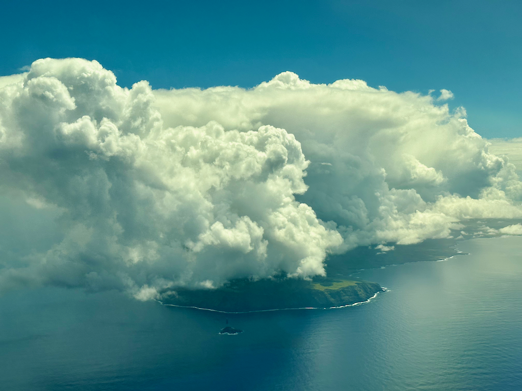
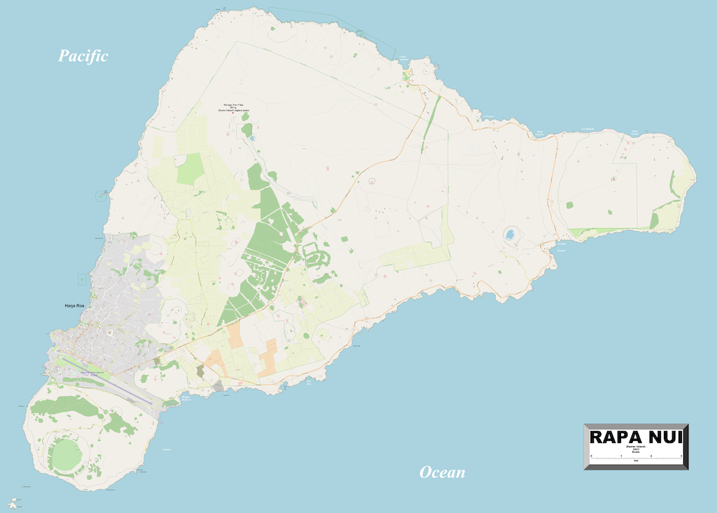
Easter Island is located about 2,300 miles off the coast of Chile and 2,500 miles east of Tahiti. At only 64 square miles (about ten times smaller than Oahu), it’s very easy to miss, which is yet another reason why it remains one of the most remote islands in the world.
In fact, the area is so remote and located so close to Point Nemo (the farthest point from land), that NASA actually set up an emergency space shuttle landing strip on the island!
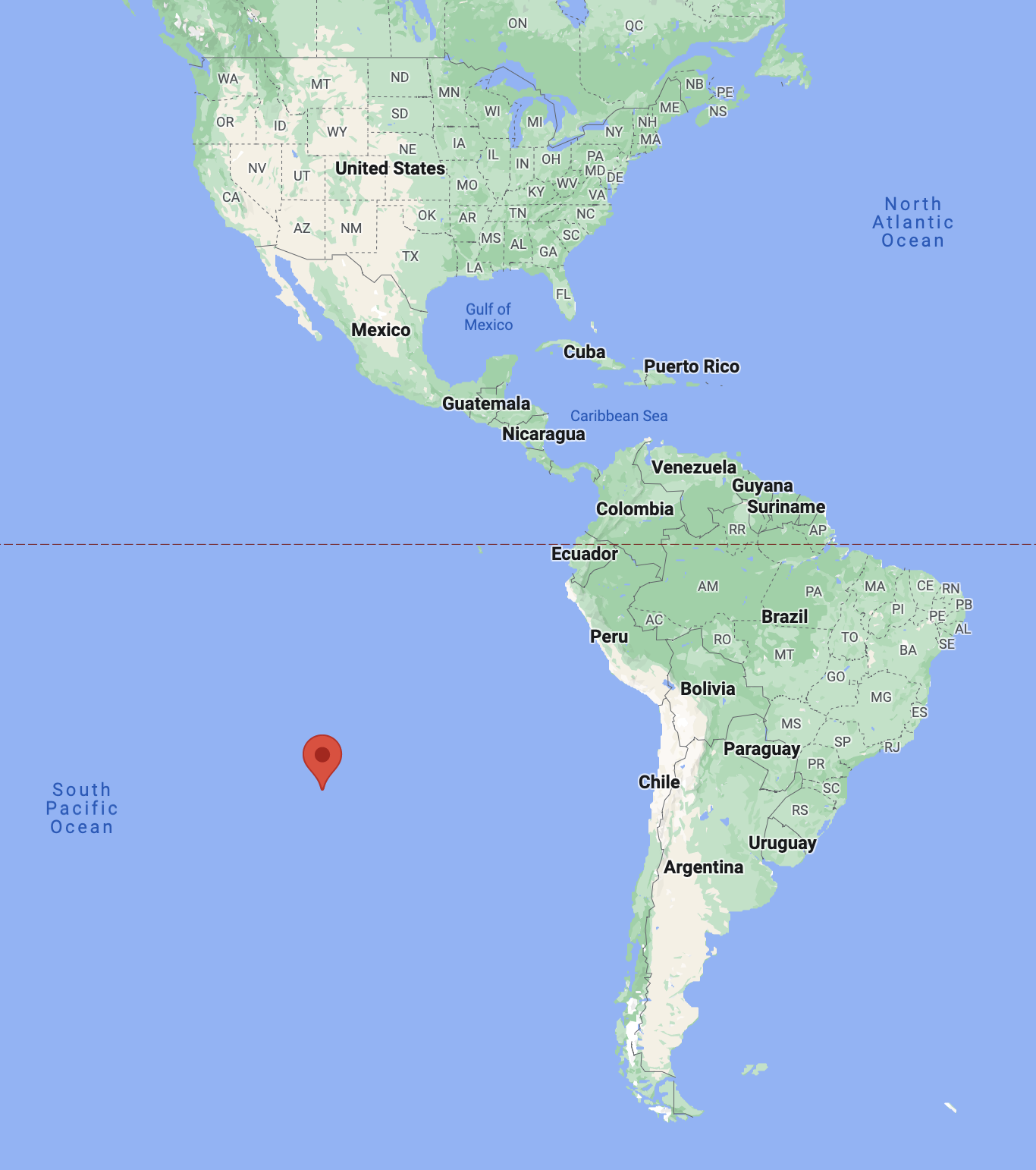
The Easter Island GPS coordinates are: 27.1127° S, 109.3497° W, which means that Easter Island is directly south of Chiricahua National Monument near Tucson, Arizona.
Its latitude also means that the island is just under the “tropic zone” and falls under a subtropical climate. So compared to a place like Hawaii, the temperatures actually get much cooler with lows dropping into the lower 60s in winter.
If you want to visit Easter Island by air, chances are you will be flying through Santiago, Chile. Since Easter Island is considered a special territory of Chile, this means that it’s treated as a domestic flight.
Before arriving at the island you have to comply with some specific requirements and present special documents and you can read more about those here.
Related Easter Island content:
- The Best Places to See on Easter Island (Recomended)
- Complete Guide to Exploring Easter Island’s Rapa Nui National Park
- How to get to Easter Island: Everything You Need to Know
- 21 Things You Need to Know About Easter Island Before Visiting
Interesting things about the location of Easter island
It makes up a corner of Polynesia
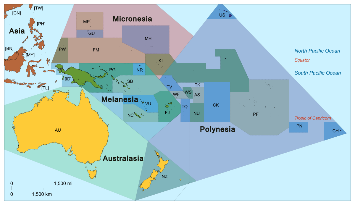
The geographic region of Polynesia is typically represented in a large triangle that spans across the vast Pacific Ocean from New Zealand to Hawaii to Easter island. It covers a huge chunk of the ocean and over 1,000 islands.
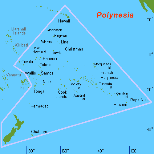
Easter Island (also called Rapa Nui) marks the easternmost corner of the Polynesian triangle (which is fitting considering that the island also takes on a triangular shape).
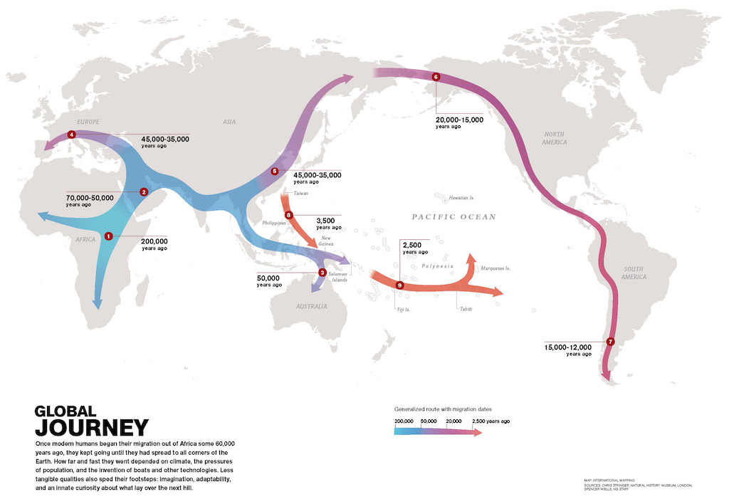
Some believe that Easter Island was the final corner of Polynesia that was settled by humans although there is debate about when exactly that happened.
This means that if you were to follow the commonly believed path of human migration out of Africa and through Asia, Easter Island would have been possibly one of the last and/or most remote destinations reached in mankind’s spread across the globe over the last 200,000 years.
Easternmost point of Oceania
Another interesting thing about the location of Easter Island is that it’s found at the easternmost point of Oceania.
It’s worth noting that not everyone agrees on exactly what makes up Oceania.
In fact, people don’t even agree on whether or not Oceania is a continent!
At the very least, Oceania is a region that makes up a large portion of the South and North Pacific Ocean. This would include: Australia, New Zealand, Melanesia, Micronesia, and Polynesia.
You need to head to the east side of the island on Poike, near an area called Cape Cumming to see this point.
This is a pretty remote area of the island and it’s not clear to me that it’s accessible although if you go with a local guide who is knowledgeable, they can probably help you get there (or very close).
Since that point represents the easternmost point of Oceania, it also would be the easternmost point of Polynesia.
Westernmost point in Chile and entire South America
Because Easter Island is way out in the middle of nowhere and is a part of Chile, it represents the westernmost point of Chile and of all of South America.
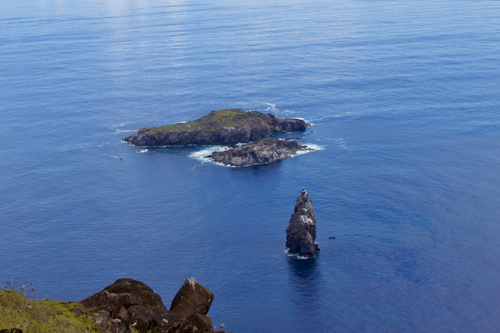
Specifically, this point is found at Motu Nui, which was an important site for the Tangata manu (“Bird Man”) cult. It looks like such a small chunk of rock but it actually is part of the 6,000+ foot mountain that is covered by the sea.
You can get a great view of Motu Nui when you visit ancient village Orongo situated on top of the dormant volcano, Rano Kau. Or, if you want to get more close to this point you can take a boat tour or potentially even do a dive or snorkel trip.
Final word
Easter Island has some pretty fascinating history and its geography is also pretty interesting.
Once you realize where the island sits geographically, you realize just how remote this place truly is.
It’s also really cool to think about its position as a boundary marker for huge geographic areas, despite it being such a small place.
Daniel Gillaspia is the Founder of UponArriving.com and the credit card app, WalletFlo. He is a former attorney turned travel expert covering destinations along with TSA, airline, and hotel policies. Since 2014, his content has been featured in publications such as National Geographic, Smithsonian Magazine, and CNBC. Read my bio.
