Saguaro National Park is a fascinating national park with many trails worth exploring. Some of these trails are easy out and back paths to follow but other trails meander through a network of smaller trails like the Deer Valley Loop Trail. In this article, I’ll tell you everything you need to know about the Deer Valley Loop Trail.
Related: West Saguaro National Park vs East Saguaro National Park
Deer Valley Loop Trail Overview
The Deer Valley Loop Trail is a great easy to moderate trail that is 4.1 miles round-trip.
It requires you to navigate multiple trail junctions in order to finish the loop but it takes you through some great scenery, and offers the opportunity to see a rare (and well developed) crested saguaro cactus. The elevation gain is very mild at only 200 feet and this is a great hike for someone looking to put their navigating skills in play.
- Distance: 4.1 miles
- Elevation Gain: 200 feet
- Route Type: Loop
- Pets: No
- Difficulty: Moderate (due to distance)
We actually did a modified version of the Deer Valley Loop due to conflicting maps that we were relying on. Our hike ended up being 3.8 miles with an elevation gain of 250 feet.
Getting to the trail head
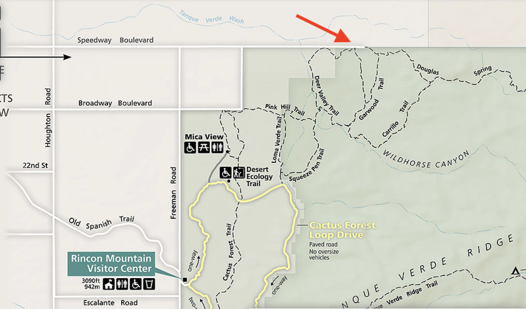
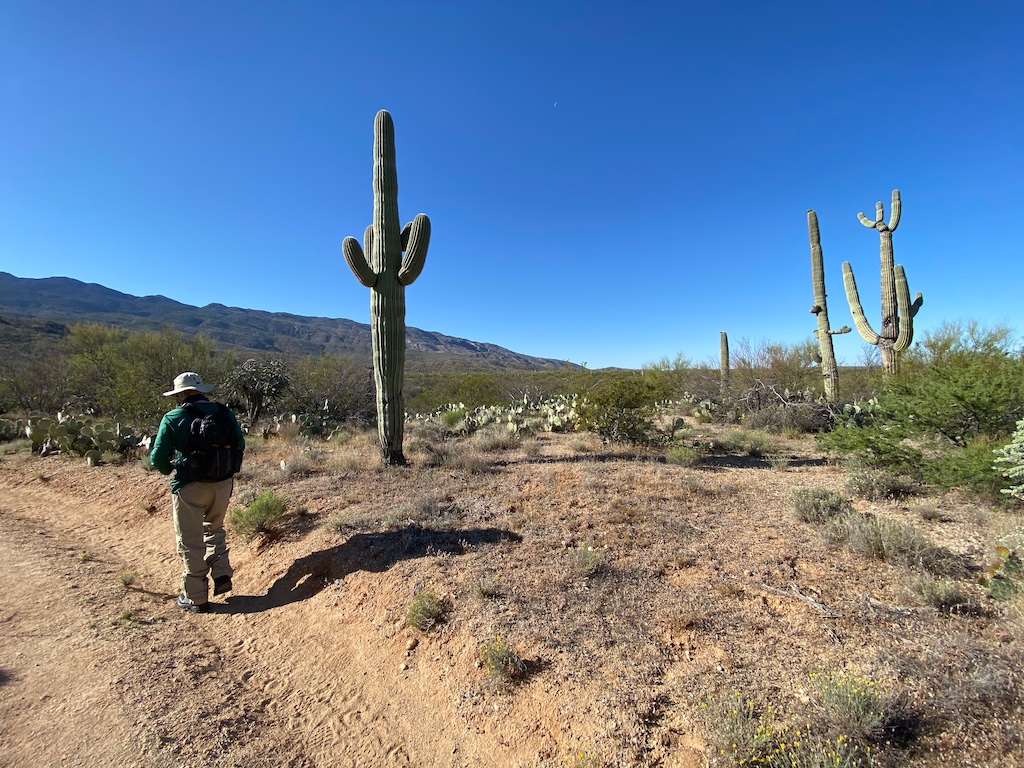
You will begin the hike at the Wildhorse trailhead which also functions as horse trailer parking. There are a lot of parking spaces there and in the area that extends to the Douglas Springs trailhead.
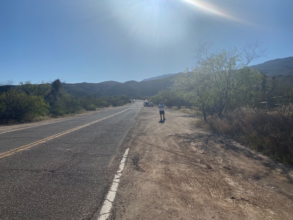
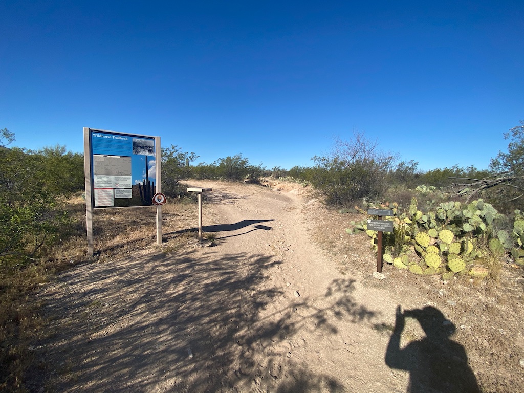
Keep in mind that this trail head is not within the Cactus Forest Loop Drive which is the main section of the park. Instead, you will find this trail head off of Speedway Boulevard which is a road that runs along the northern border of the East district.
Trail conditions
The trail is easy to moderate with little elevation gain and is also extremely well-marked.
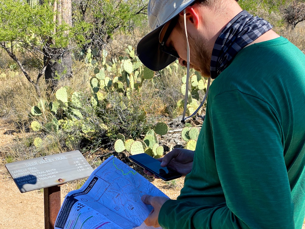
While the trails are easy to follow, there are many trail junctions along this loop. Each of them is marked well with posts so it should not be that difficult for you to know which route you are heading to. Still, with so many different trail junctions, a beginner hiker will probably prefer to have some type of GPS tracker with them.
The thing that got difficult for me is that I had two different types of maps I was using.
I used this map from the Saguaro National Park website but it looked a little different from the hiking map issued out from the visitor center because the map from the visitor center does not show Deer Valley Wash as an actual trail and neither did the AllTrails app.
I did not realize that until we were in the middle of our hike so that kind of threw me off and is something you should consider if you are using that same map linked above.
(Note: It’s possible that that wash trail is currently closed.)
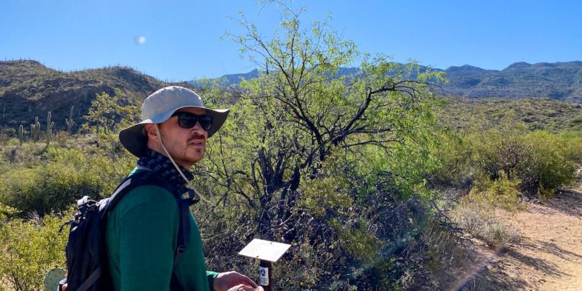
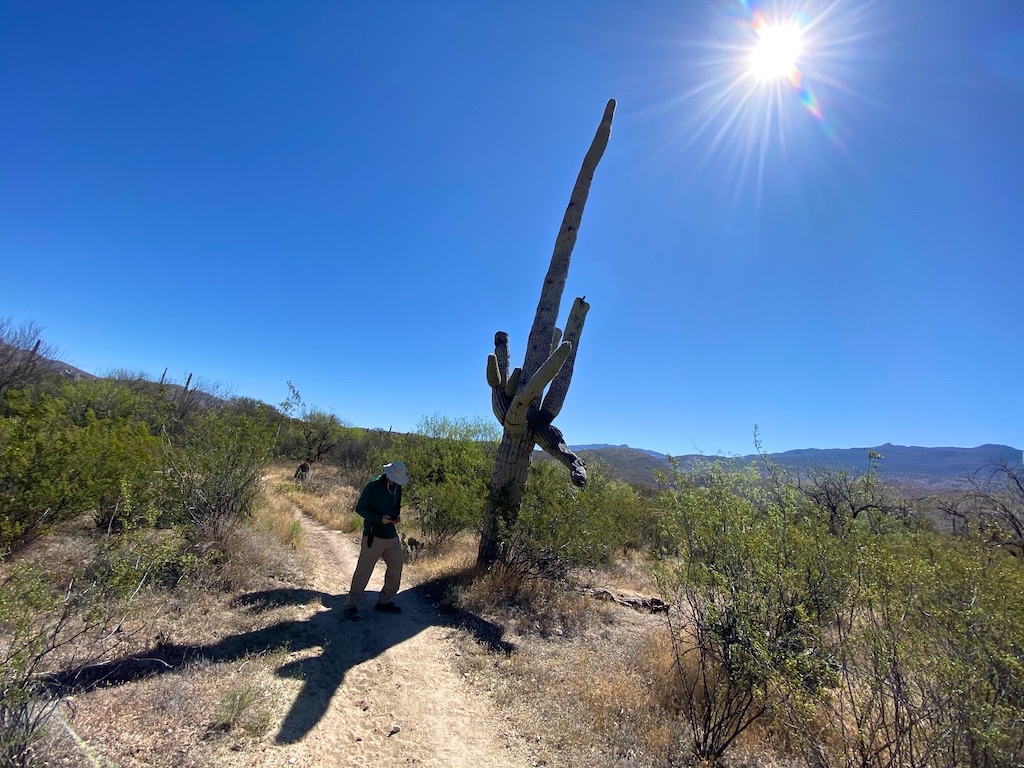
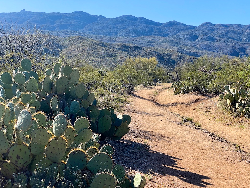
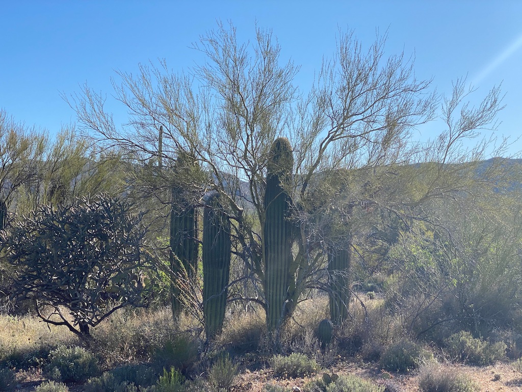
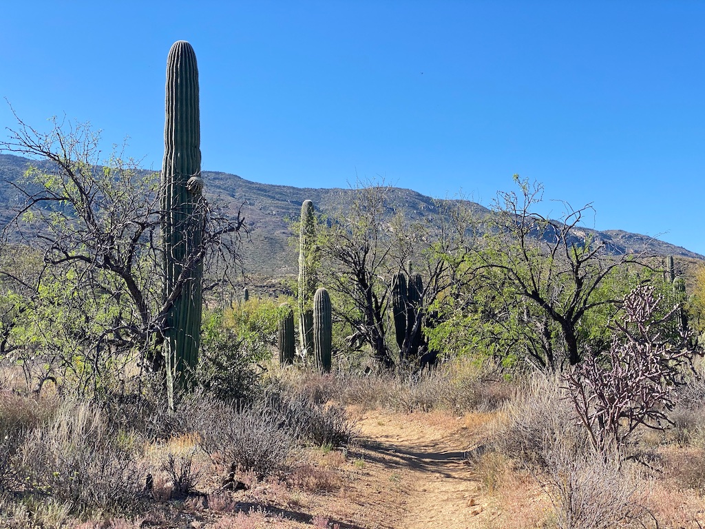
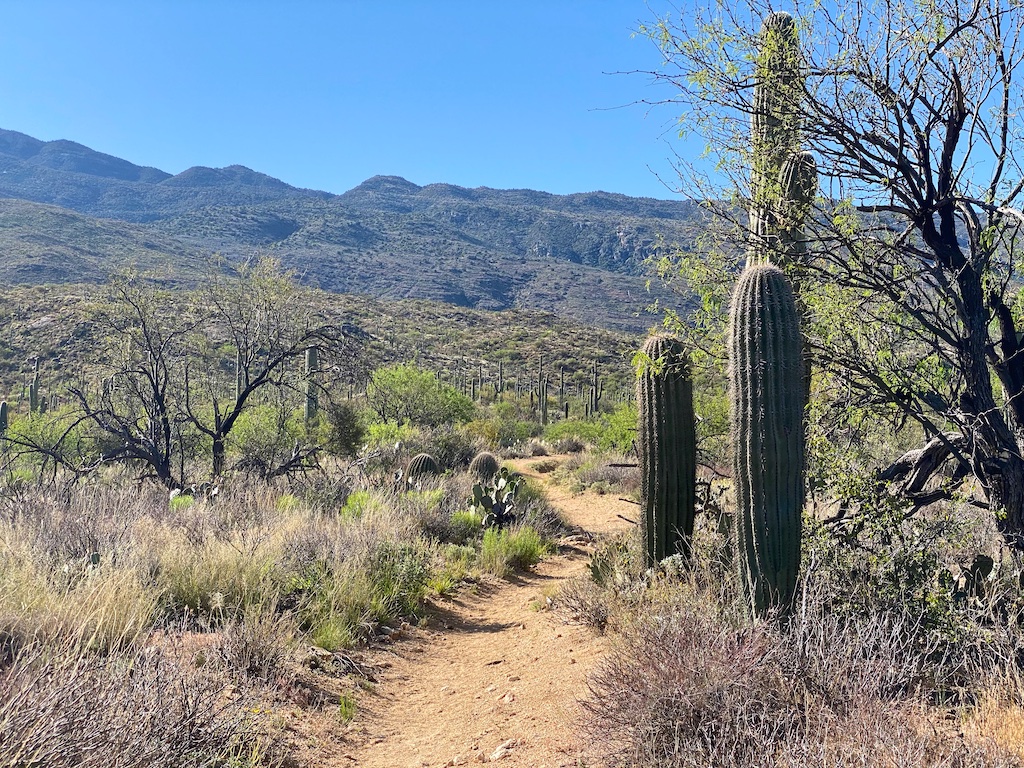
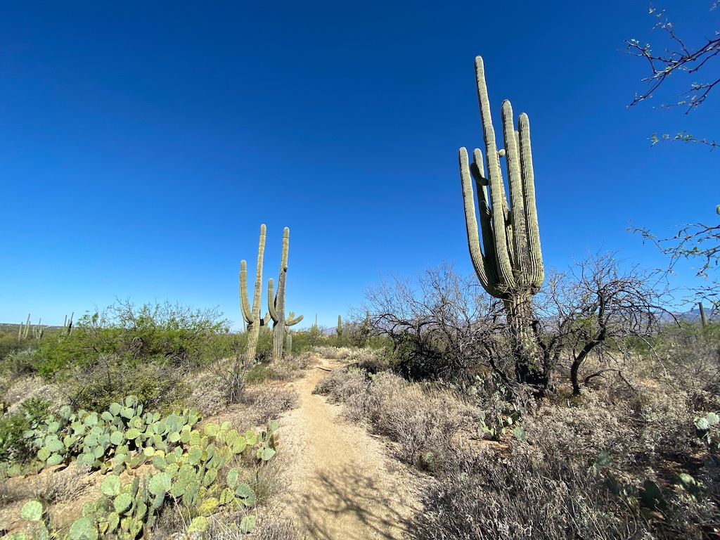
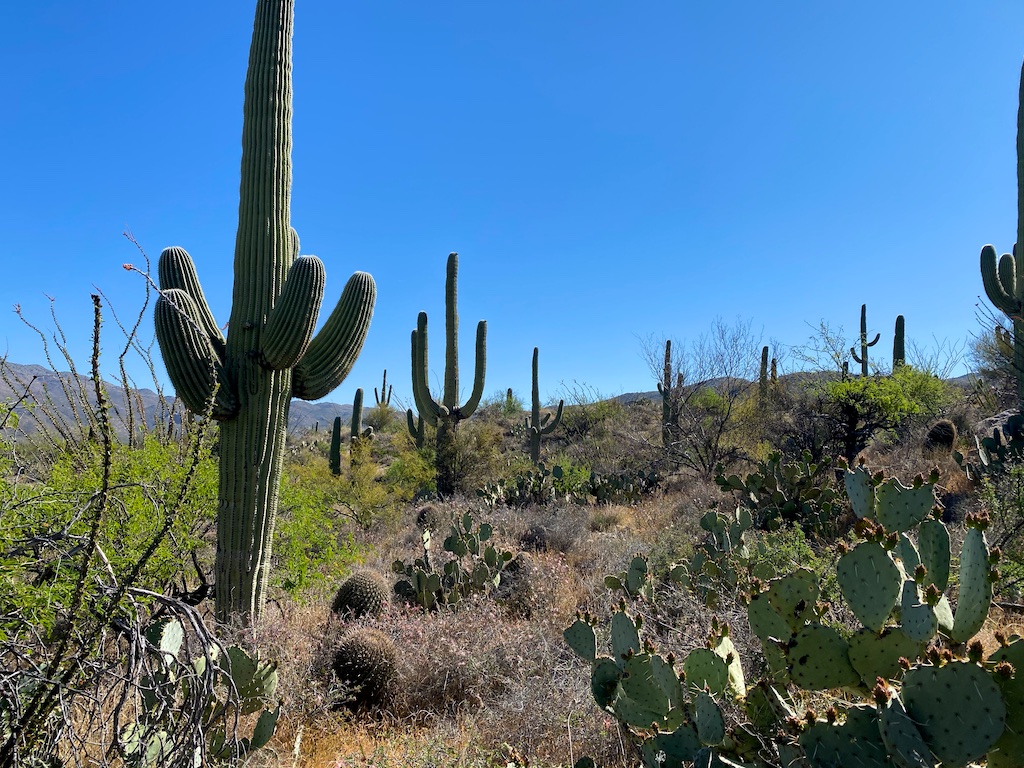
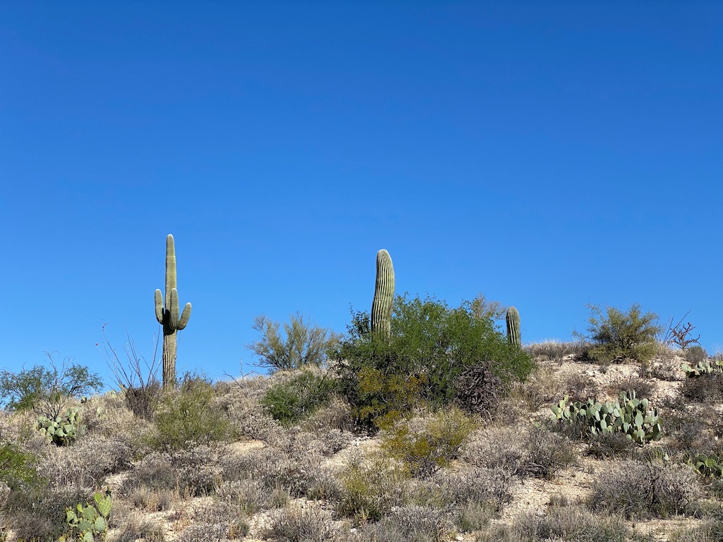
The trail is a pretty typical Saguaro National Park trail. Well-maintained, great scenery, lots of different desert vegetation, etc.
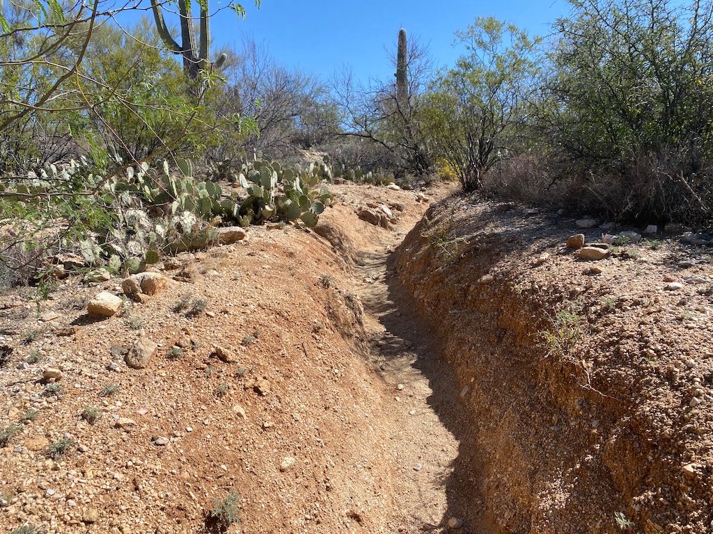
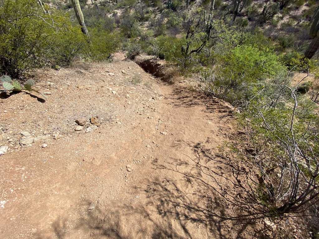
Some parts of the trail are shallow trenches, sometimes with an alternate path that goes along the top side of the trench.
Many horses traverse these trails so horse droppings will be found in a lot of places and sometimes when making your way through a narrow trench, it is hard to avoid stepping in those.
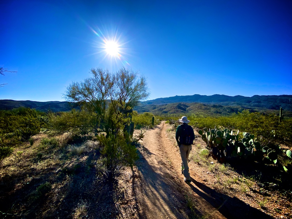
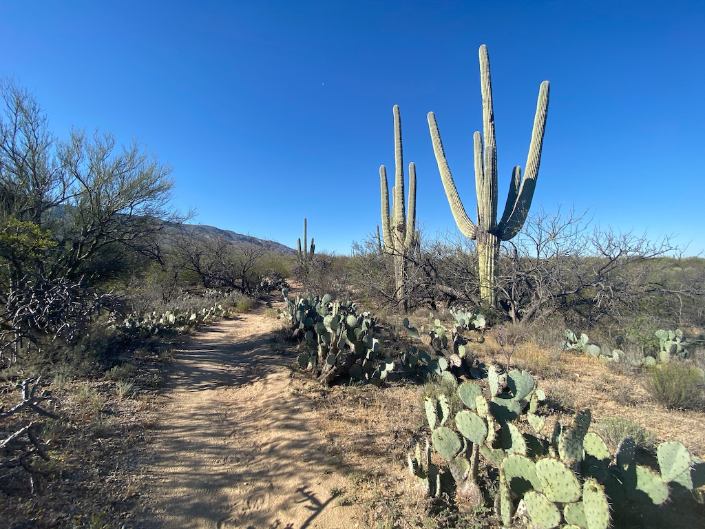
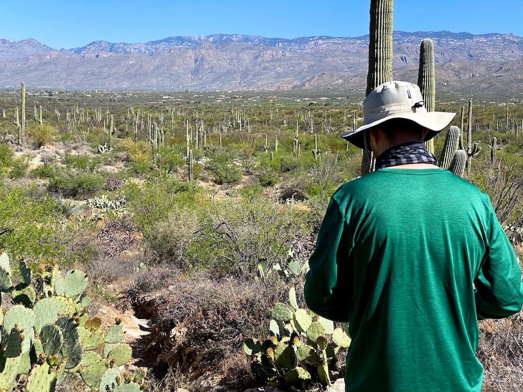
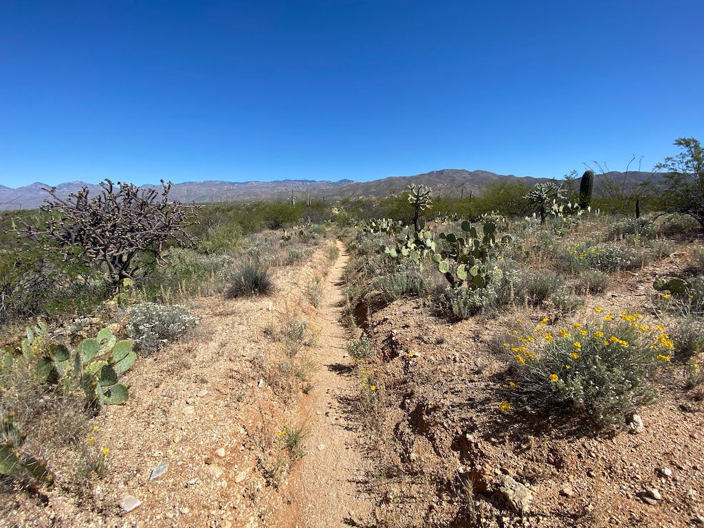
Other parts of the trail are quite wide and also open up to some fantastic views of the neighboring mountains, such as the Rincon mountains pictured below. When there is elevation change, there typically are well built steps that you can use.
Like most trails in this park in the lower elevations, there will be little to no shade along the way unless you get creative.
Route description
You will first head south on the Wild Horse Trail and cross the Bajada Wash. There are some great views of the nearby foothills along this path and you’ll come across some small families of saguaro cactuses hanging out under nursery trees.
After crossing the Bajada Wash, you will continue down the Wild Horse Trail and at the triple trail junction (one mile into your hike) bear right on the Garwood Trail.
This portion of the trail is going uphill but at a very mild incline that is not difficult. You’ll see plenty of noteworthy saguaros on the way.
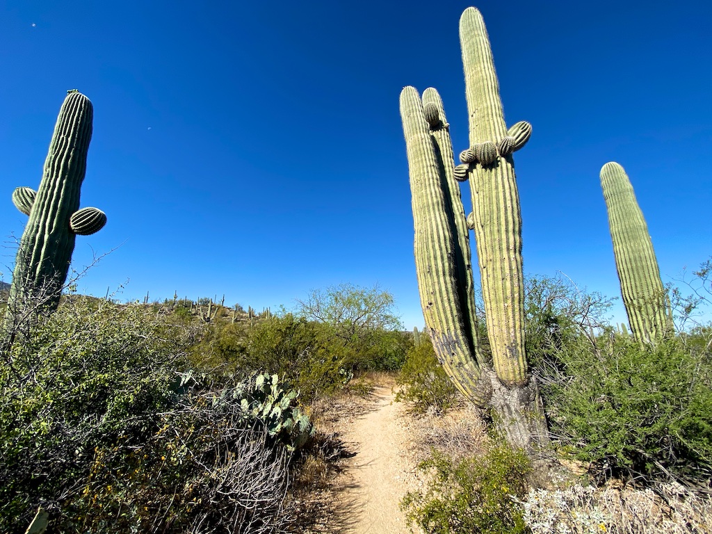
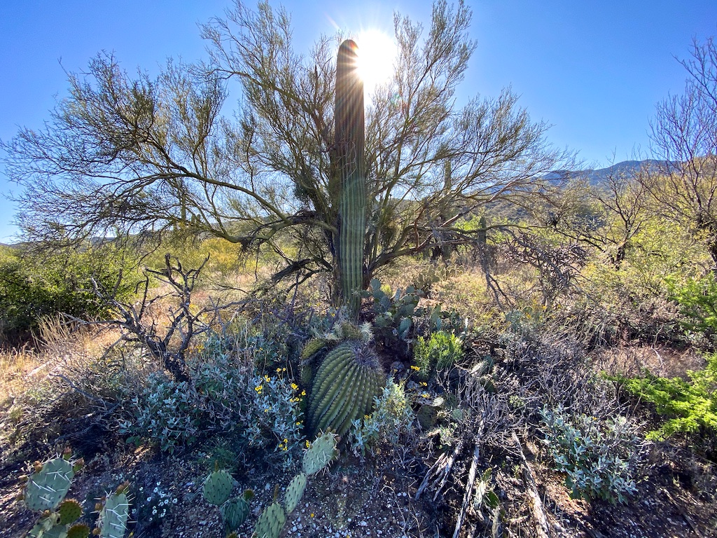
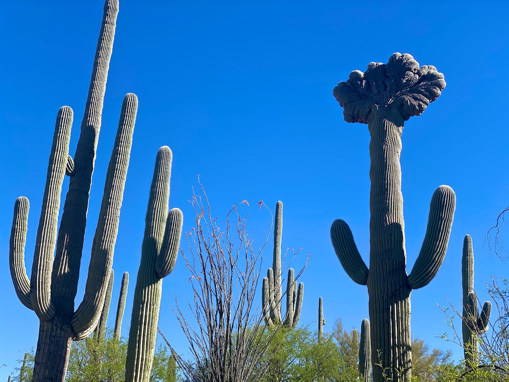
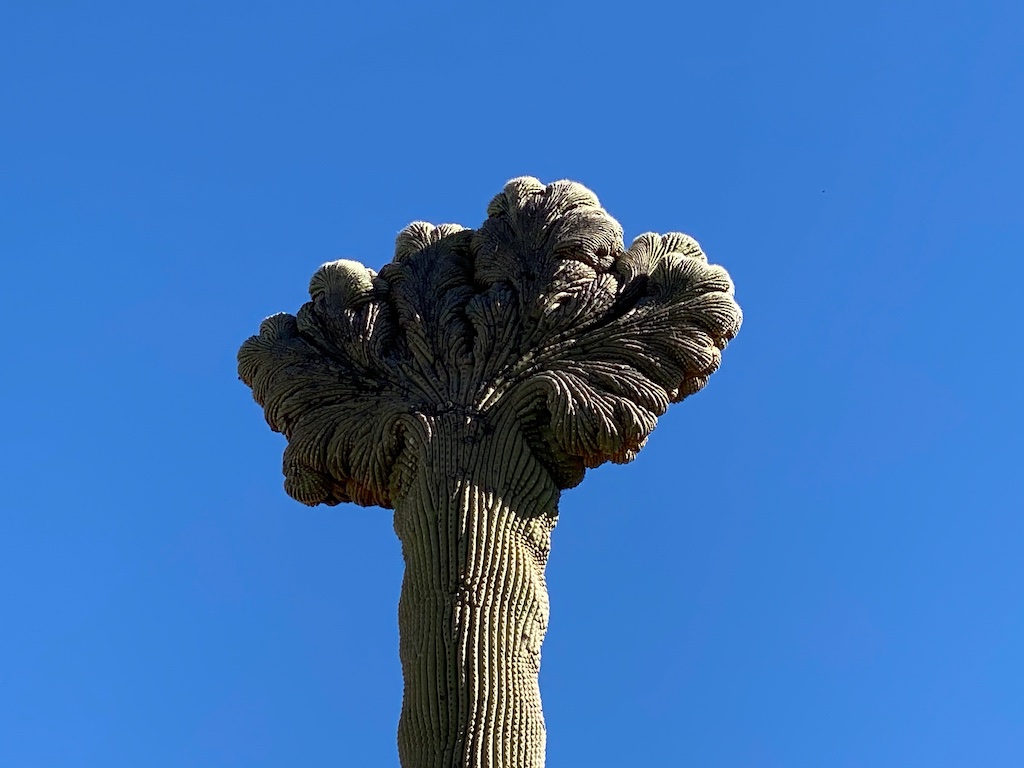
Look for the rare crested saguaro as you approach the main wash. It will be on your left.
Head down the Garwood Trail for just over half a mile and then you will turn right onto the Carrillo Trail. This trail heads west along the ridge overlooking a wash that I believe has seasonal flow at times. It also has one of the more impressive saguaros that I’ve seen with the huge trunk.
You’ll then proceed downhill for about .3 miles and turn right onto the Deer Valley Trail. At that point you are about 1/2 through the hike, so consider preserving your water supply if needed.
You will continue downhill on that trail until you reach the Squeeze Pen Trail at which point you will take a left and then a quick right again onto the Deer Valley Wash. Normally, you would follow the wash north, past the Vanover Trail until you get to the Shantz Trail and then take the Shantz Trail back to the trailhead.
But the junction of the Deer Valley Trail and Squeeze Pen Trail is where we departed the route and took a right on the Squeeze Pen Trail.
This portion of the Squeeze Pen Trail heading north has some great views of the Santa Catalina Mountains.
As you had more north, the trail starts to get more trench-like and narrow. I enjoyed hiking through the narrow trenches but didn’t care for all of the loads of horse manure we had to dodge.
It also had a semi-steep point just past the Bajada Vista Trail so just be aware of that if you choose to go that route. Overall, it’s a very short segment of the trail so nothing to really worry about but it is the one section where I thought I could have really used trekking poles.
After we got out of the Squeeze Pen Trail and made our way on to the Kennedy Trail, it was pretty much a straight shot to the Shantz Trail which completed the hike after only about 1 mile and some slightly declining elevation.
Since we did not head down the Deer Valley Wash, we missed out on checking out some of the deep rooted mesquite trees along the banks of the wash something I would have liked to have seen.
Vegetation
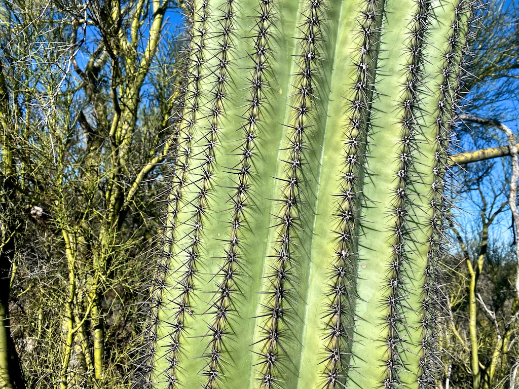
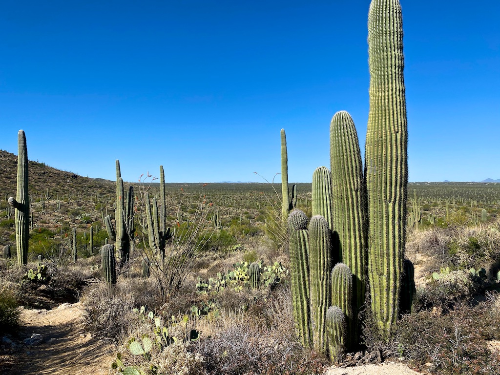
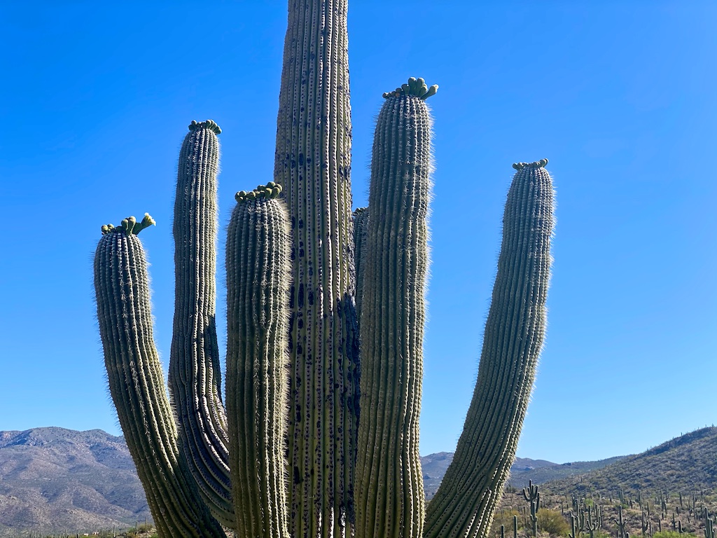
There are a lot of tall saguaro cactuses along this hike. You will see many unusual forms and be able to get up close to many of these.
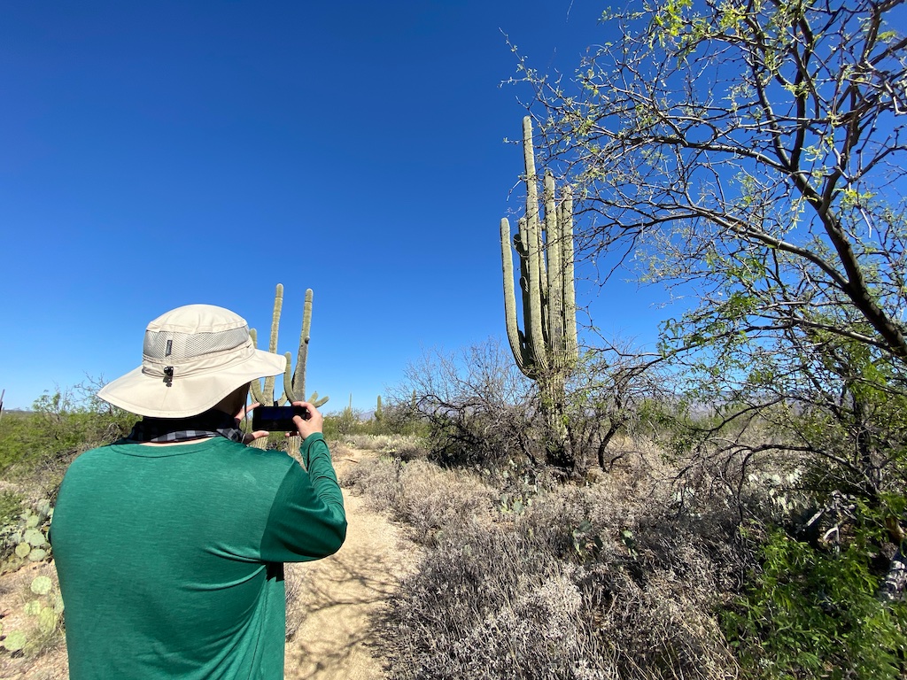
The most gnarly saguaro cactus has to be the crested one that you will arrive at as you near the wash crossing on the Garwood trail. I have seen some other crested saguaro cactuses but this is definitely one of the better ones. So if you are interested in seeing a crusted saguaro cactus up close, this trail is perfect.
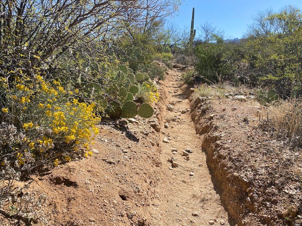
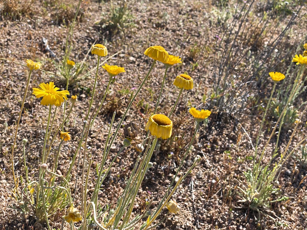
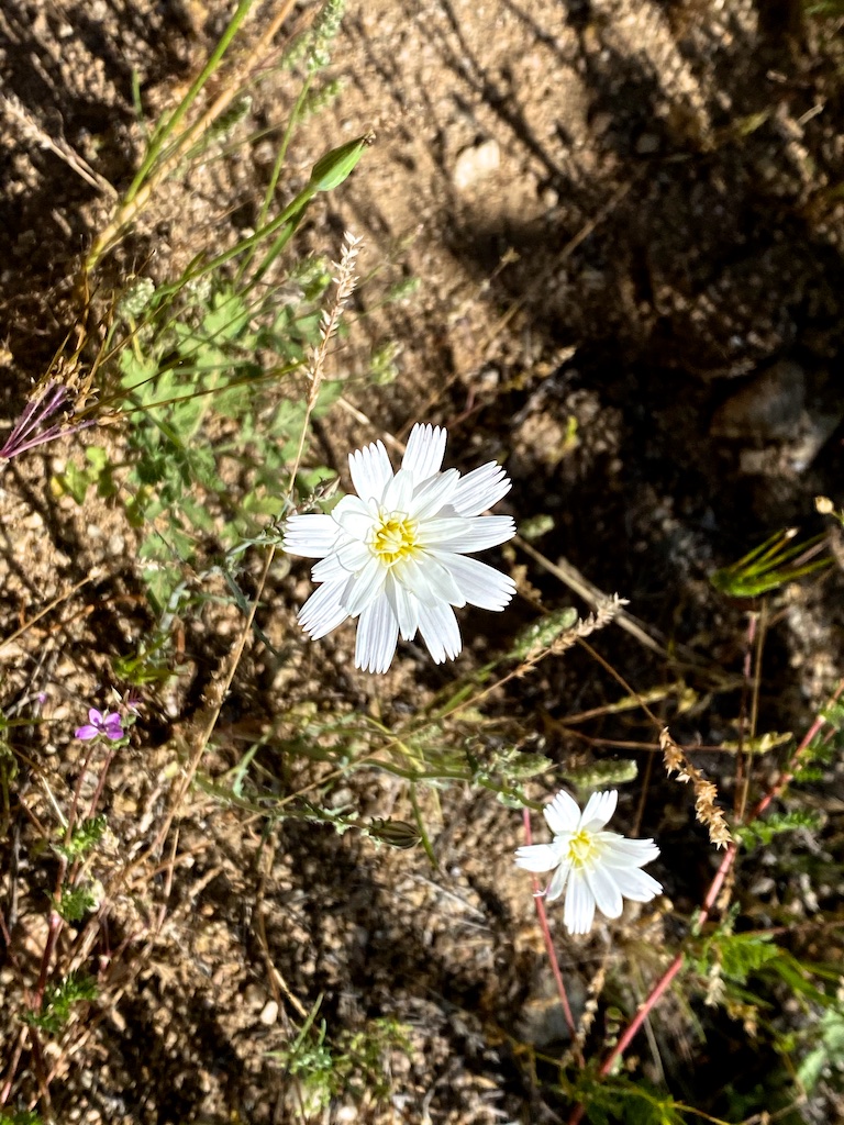
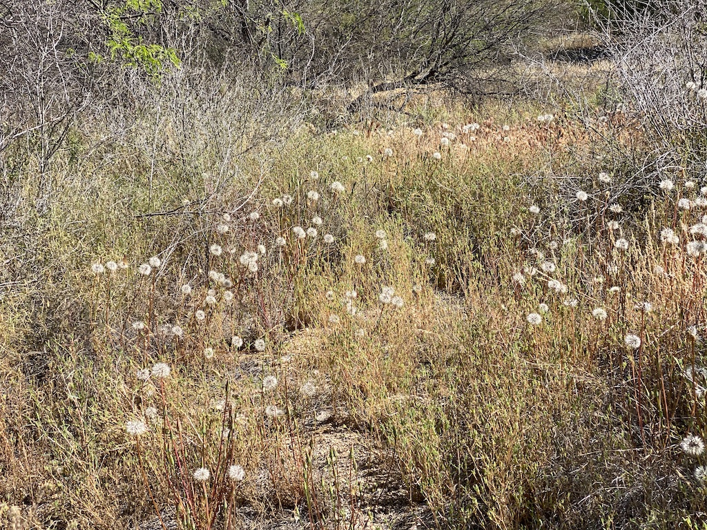
There also was a pretty good display of wildflowers.
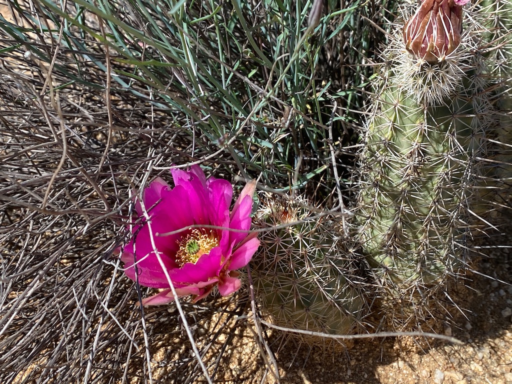
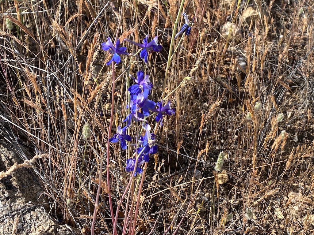
The saguaro cactuses were just on the brink of blooming with lots of their little buds sitting on top of them and an occasional white flour poking out.
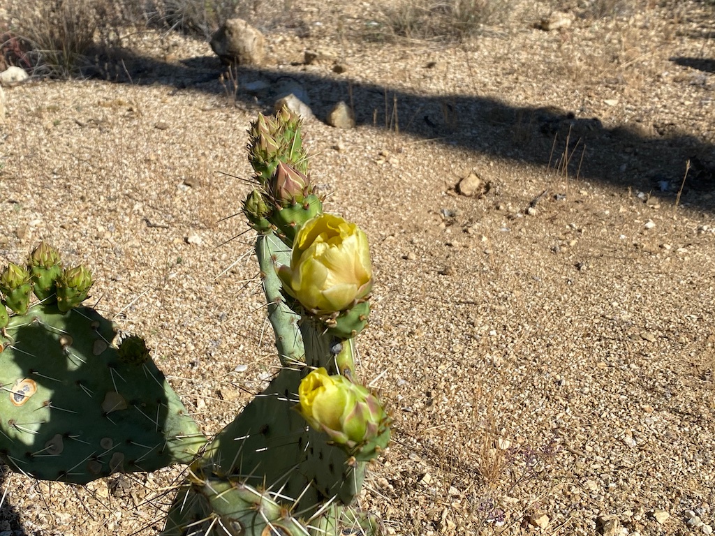
Some of the prickly pear cactus were very close to blooming as well. I think these are known to bloom in early summer though.
Interestingly, it seemed like the hedgehog cactus were just a little bit behind most of the other trails that we have done in the past couple of days like the Cactus Forest Trail which of had much more brilliant displays of hedgehog cactus blooms.
Wildlife
We did not encounter a ton of wildlife during our hike, but we did see many butterflies fluttering around and also saw a few small lizards scurrying about.
Final Word
Overall, I would highly recommend this hike simply because of the amazing saguaro cactuses you will see along the way, including the trippy looking crested saguaro cactus. There are also some very solid views of the surrounding mountains and foothills to enjoy throughout the hike which I really liked.
The wildflowers were not as intense as some other hikes like the Cactus Forest Trail or Tanque Verde Ridge hike but when the saguaros begin to bloom, this would be a fantastic route to admire them.
Daniel Gillaspia is the Founder of UponArriving.com and the credit card app, WalletFlo. He is a former attorney turned travel expert covering destinations along with TSA, airline, and hotel policies. Since 2014, his content has been featured in publications such as National Geographic, Smithsonian Magazine, and CNBC. Read my bio.
